Have A Look At The Other Face Of Georgia
Hey friends I'm trying here to give you all some information about the tourist places that are available in Georgia. Georgia is a culturally rich country having caucassians as the main ethnic group of people. The country encloses a wide range of geographically distinct places of which some I had already explained in my previous articles. Each place has its own chronicle and some archealogically valuable possessions. Adding to this is the natural beauty of each place that attract people and tourists. So today I would like to write about a region in Georgia called Shida Kartli.
Reaching the region of Inner Kartli the first question that may arise in your mind and it is not that much tough. Buses and Mini buses are available from different bust stations in Tbilisi and also other important cities like Kutaisi, Bakuriani, etc. From Tbilisi buses and mini buses leave from Vukzali bus station, Orthachala bus station and Didube bus station. Frequent train services are also available to this region with one of the important station being Gori. Trains that leave from Tbilisi will start from the Tbilisi Central Railway Station located in Vukzali.
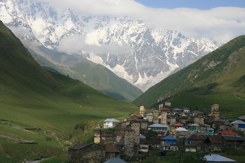
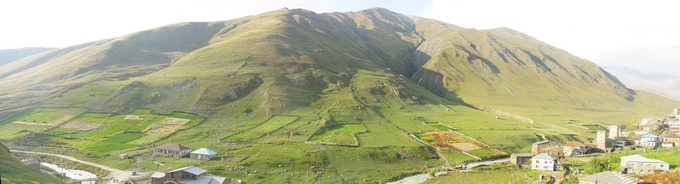
Inner kartli in Georgian called as Shida Kartli is a region on the eastern side of Georgia which includes the centre part of the historical and geographical province of Shida kartli. Its one among the big regions in Georgia comprising a good number of inhabtitans with its administrative centre being the town of Gori which is the birth place of the world famous Dictator of the Soviet Union who is none other than Joseph Stalin. This regions is bounded on all four sides by natural sources like the Aragvi river from the eastern side, Caucassus mountain range from the north, Likhi mountain range from the west and the Trialeti mountain range from the south. The old name for this region was Zena village, This region is rich in water the most important natural resource in the world. The part of the region that is found south to the Mtkvari river is called the "Other side" which in Georgian language is Gagmamkhari. There are numerous lowlands created by the rivers that flow through this region such as Dzama, Tana, Tedzami and Kavtura. In the northern side of Mtkvari there are beautiful valleys like Doghlaura, Triponi and Mukhrani. These valleys are cut by the rivers that flow in these regions like the Liakvi, Lekhura, Ksani and Aragvi. From all these you could now very well see that there is no deficiency for rivers in this region and moreover the region has a lot of natural springs and rivers with medical value. However this is not a wonder for a region that has a lot of rivers flowing within. Its predictable that with this abundant water resources the main occupation of the people in this region will be agriculture. The water from all these rivers are used for irrigation purposes apart from which the climatic condition of this region also provides a good support for farming. There is also a wide variety of livestock raised in the region of Shida Kartli. The important land and rail routes for this region are located on its south side. Therefore the imprtant cities such as Gori, Kaspi, Agara are important commercial and business zones of this region.
Exploring the history of this region we get to know some interesting facts. The kingdom of Kartli was a part of the Iberian kingdom which in todays world forms a part of some of the countries like Georgia, Azerbaijan, Armenia and a small part of Russia. I have already mentioned about the history of Colchi's in an article about Samegrelo which is another Georgian kingdom in one of my older article here. In the middle period of history Inner Kartli or te Shida Kartli was a part of Kartli Saeristavo which literally means an administrative unit. In the later periods the region suffered a terrible Mongolian invasion where they began to lose some of the smaller administrative units within the region little by little. Some of the administrative parts that were lost were Aragvi saeristavo, Sacicano saeristavo, Saamilakhravo saeristavo, Saajavkho saeristavo, Samachablo saeristavo, Samukhranbatono saeristavo after which the Kartli kingdom was dispersed into four small military units of which three of them were inside the kingdom of Kartli. After this the region was incorporated into the Soviet Union where it was made a province of Gori under Dusheti region.
Considering the climate of this region it is completely different from the western part of Georgia. The climate in this region is dry and continental with an exception of th great caucassian range in the north and some parts that are at an altitude of 3000 to 3500 metres above sea level where it is humid and the peaks of the mountains are covered with snow all throughout the year.
Getting into the different towns of the Shida Kartli region the first one to consider is its administrative center Gori. The name of the town Gori has a great history behind it. The city is just at a distance of 96kilometres from the country's capital Tbilisi. It is located at a level of 500 metre above sea level. Getting back to the history, the name of the city is considered to be associated with a hill in the city where the ancient fortress of Gori was built. In the records of history its been mentioned that while the Byzantine emperor Cesar Heracles was fighting a battle in the caucassian region he hid is treasures by burrying them inside the fortress of Gori and this may be the reason why this fortress is regarded as the Tontoid which in Greek means a "Mountain of Gold". The fortress was under the control of several foreign invasions in the forthcoming centuries and after annexing the region into Soviet Union the fortress was gained control by the Georgians. However certain earthquakes severly damaged the fortress and at present it has lost its form however Tshkra kara which means the 9th gate is only solid till date and it also has a church nearby.
As I mentioned before the city of Gori also has a moderate dry to moderate humid climate, however th summers are hot in the city. Apart from the historical fortress of Gori is also known for the birthplace of one of the best dictators of soviet union, Joseph Stalin. There is a museum dedicated for this dictator in his birth town which is located in the centre of the city. The museum has three sections which are named as his home, museum and railway carriage. The house of Joseph Stalin is a small hut in which he spent his first four years of life as his father was a local shoe maker and his father rented a small room nearby where he had is workplace. The next part ie, the Stalin's museum is a large building that is divided into six halls where exists a wide collection of articles used by Stalin such as his office furnitures, newspapers, gifts given to him, one copy of the death mask of Stalin, documents, letters written by him etc. The third part of the museum holds Stalin's personal railway carriage that was made for him specially. The carriage weighed several tons and it is bullet proof which was used by Stalin for travel. Archealogical findings state that this region in the beginning of our era served as a settlement area and they have discovered some possessions and coins that belongs to 15th century. The coins that were found during the excavation are considered to be the belongings of some Kings and Lords of that time. Apart from this rich history the city of Gori has numerous places to visit like historical monuments, churches and monasteries, ancient settlements, museums etc. However in the recent past there was a war in the south ossetian region between Georgia and Russian claiming power over the region in which the city of Gori suffered a serious attack and thereby proposals are going on for converting the Stalin's museum into a museum of Russian war influence of the region.
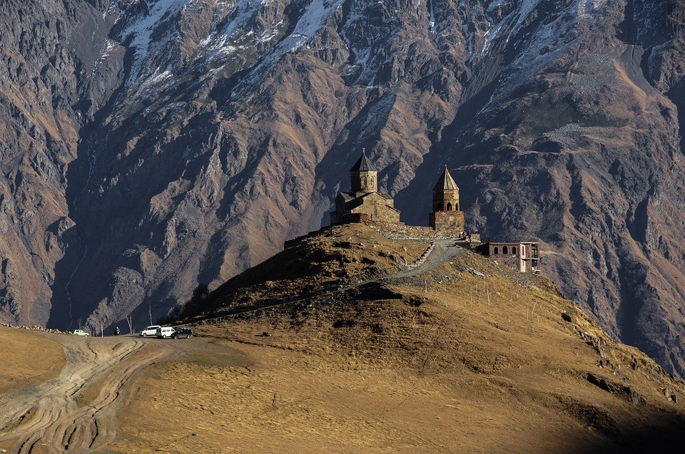
Apart from the historical city the region of Shida Kartli has some culturally rich zones which includes some major monasteries and ancient settlements some of which I would be describing here.
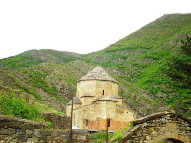
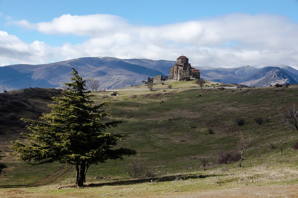
Ateni Sioni Church is an old monument that is dated back to 7th century. It is a domed church which is located a distance of 10kilometres from the city of Gori on the bank of a river called Ateni. The church is placed on the top of a hill and the name Sioni is considerd to originate from the Zion of Jerusalem. The church is decorated with carved quadrangle greenush gray stines and ornaments. Inscriptions that are considered to be the scripts of early Georgian language are found in this holy church and moreover the church resembles the curch that is found in Mtskheta.
Kinstvisi Monastery is a Georgian monastery complex located at a distance of 10 kilometers from a town called Kareli. The monastery is built in the name of Saint Nicholas which forms the main church of the complex. There are also two other small churches dedicated to Saint George and Saint Mary. The church of Saint Nicholoas is built of rock therefore it doesn't have any incarnations which is typical for Georgian architecture. This feature also distinguishes the church of Saint Nicholas from other churches in Georgia. Inside the church is decorated with frescoes painting depicting some of the incarnations, resurrection and one such fresco containing an archangel is very famous.
Samtavisi church is located in the kaspi municipality in the center of a village called Samtavisi. The church is considered to be built in the 400's under the rule of a king called Vakhtang who has been mentioned in the Georgian chronicles. The church has inscriptions on its walls which supports this theory. The church has survived numerous catastrophies and still remains functional although there are no remains of the past.
Uplistsikhe is an ancient rock hewn town that is dated back to the first mellineum BC. It is considered to be a place of settlement of the Kartli's and the place has two settlements one that is inside the caves and the other which is found near the rocky mountains. From the 4th century the importance of the town declined and then became deserted. The meaning of Uplistsikhe means the Lords Fortress and at the top of the hill there is a small church. Now a days the cave city with its secret tunnels, rock architectures is a fastly developing tourist spot. I've described my complete experience at Uplistsike in one of my articles in the Experience section.
Rkoni monastery complex is located in the Inner Kartli region of Georgia within the kaspi municipality. In the 12th and the 13th century there was an important trade and military route that was passing through this region and therefore very large monasteries were constructed in this area. This road connected Inner Kartli to Javakheti, Trialeti and Armenia. Due to this potential roadway the region was prone to invasion many times. In 1400 Temurleng army destroyed the village including all the churches and the monasteries in the area. In 16th to 18th century Rkoni gained back its strength and it was well protected from enemies. In 1905 Rkoni accomodated workshop laboratory inside which weapons, explosives and crucial equipments were built for revolts.
Urbnisi is a village in the Inner Kartli region in the Kareli municipality. Archealogical excavations made has dated back the monastery to 3rd millenium BC to 18th millenium AD. The monastery complex has several ancient structures like a wine cellar, a water pipe, a bell tower, a basilica called as the Urbnisi's Sioni etc. There are evidences of burnt places and catapult stones which suggests that the entire area may have been under attack and all the wealth being looted.
Saint Stephen Monastery is an important complex located in the Urbnisi village of the Inner Kartli region. It was built during the 6th and 7th century and the three naive basilica's of the church were rebuilt twice in 10th century and 17th century. The three naive pillars are placed upon twelve pillars making it quite a large and strong church. Several inscriptions are found on the walls of the Urbnisi monastery complex which are considered to be Georgian alphabets of the 7th century. The village of Urbnisi was under attack by the Arabs in the early time and it is been said that the Saint Stephen Monastery served as a orthodox christian center for the people of the area. There is a residence of the bishop in Urbnisi and the monastery complex began functioning with many monks living in the very recent past.
Ruisi Cathedral Of Divinity is also located in the Urbnisi village in the Inner Kartli region in the Ruisi village. The cathedral was built in the 8th to 9th century. The Ruisi cathedral also functions as the center of eparchy for this region. It has wall, a tower, a bell tower etc and it has been renovated many times since the 18th century. An earthquake in 19th century seriously damaged the cathedral drawing the attentions of the government officials who began to rebuilt the damaged cathedral. The bell tower built in the 17th century is a three storey building located on the west side of the cathedral. Remains of the fortress sourrounding the cathedral are found on the south side and there is also a wall that surrounds the cathedral that is believed to be built in the medeival period. Several ornaments dated back to 10th and 11th century have been found here.
Kvatakhevi is a Georgian orthodox monastery in the Inner Kartli region of Georgia that is considerd to be built during the medeival period somewhere between th 12th and 13th century. It still stands as a marker for Georgian domed church architecture and decoration. When the Arabs invaded Georgia in the 14th century the church was severley damaged however the damage was restored in the 18th century by the prince of that time. The monastery complex is surrounded by a wall with two openings. One opening is on the south and the other on the west side of the wall. White stones adorne the facade and the eastern facade has a large ornate cross. The bell tower which is built of rock is two storey building that also served as a resedential place. On the west side of the wall there are residential places that dates back to the 19th century.
Tsromi Cathedral is located in Khasuri municipality in a village called Tsromi. It was a prominent cathedral back in the 4th century. The church that is found today was built by Stepanoz II in the year 626 to 634. It was destroyed several times by several factors. An earthquake that occured in the 19th century heavily damaged the cathedral.
Surami Fortress is located in the town of Surami which is at a distance of 4km from the Khasuri municipality. It is located in the southern slopes of Likhi range and has a strategical position connecting the eastern and western parts of Georgia. The exact time period in which the Surami fortress was built is still unknown. The town of Surami existed from the XIth century. The fortress was under the control of several people such as Giorgi Sakadze, Osman conquerors and in the 70's Georgian and the Russian soldiers. There are also nine churches near the fortress. There is also an important mountain pass in the Likhi range called the Surami pass that connects the east and west Georgia. A railway tunnel as well as an important roadway currently runs through the pass. Surami is also located close to the famous Borjomi - Kharaguli National park which is an importan tourist attraction site in Georgia.
Skhvilo Complex is located in Kaspi in the Inner Kartli region. The complex is placed in the high mountain slopes from the IXth century. The complex includes a wall that is about 14m in height and 2m wide, a main tower, a church, a residential building and a water reservoir.
Saint Ioane Natalismstsemeli Cathedral is located in the Khasuri municipality in a place called Khtsisi. The cathedral in this Inner Kartli region is located right inside a forest and the construction started in 1002 by a bishop called Anania. Currently there is a monastery in the place and all the information obtained about the cathedral were got from the inscriptions in the cathedral's facade.
Archeological monument of Dvani is a big grave field of 6th to 7th century BC located in a village called Dvani in the Inner Kartli region. The place is on a mountain slope on the bank of a river called Proni. There were 14 grave fields in which some were covered with cobble stones. Archeological excavations have also unearthed black and red burn earthware, silver and bronze materials.
Khizaant Gora is an archeological monument in the Inner Kartli region located in a village called Urbnisi in the bank of the river Mtkvari. 12 antique cultural strata were discovered from this area with a total width of 8 metres. A grave field that belongs to the bronze age was also discovered here. Resedential places dating back to 1st and 3rd centuries BC were discovered in this region. Typical square type houses that belongs to Kura Araxes culture have also been found in this grave field. Additionally there was also a huge fortress with six seperate storage areas that belongs to 6th century. The fortress is surrounded by a wall and the area between the tower and wall was paved.
The region of Inner Kartli offers the visitors a wide variety of tours like archeological, educational, piligrimage and cutural tours. This region is also known for its agriculture and therefore agro-tourism is promoted in this region. Walking tourism combined with local culture are one of the main tourism type in the Inner Kartli region. On the whole it can be concluded that the region of Inner kartli will show its visitors an entirely different place compared to other parts of Georgia. Thanks for reading and will talk to you all in my next article, till then keep smiling and cheers..!
Photo gallery
Content available in other languages
- Español: Échale un vistazo a la otra cara de Georgia
- Italiano: L'altro lato della Georgia
Rate and comment about this place!
Do you know Shida Kartli Region Of Georgia? Share your opinion about this place.