Although we have already spoken about the various routes you can do by bike near Valencia, such as the track which connects Valencia with the region's northern cities including Almenara, and over the course of two blog posts, we also went over two of Valencia's southern routes, one which goes towards Valencia's coastal lagoon, and another which goes towards Cullera.
And although these routes are highly recommended, if you ask any Valencian what is the best green zone for a bike ride, they will undoubtedly respond that the best place is the old riverbed of the Turia river.
How to get there

Although for a tourist it's best to do part of the route on foot, I advise going there and back on bike. If you use a bike to get to the Arts and Sciences Museum area, you will be able to take advantage of the cycle lanes. I recommend going along the bike lane from Malvarrosa beach, and deviating when you reach Valencia port.
There are also various buses which go towards this area of Valencia, and normally the bus is the number 95, but look at the area of Valencia in which you are in case there is another bus line.
When it comes to trains, the closest station is the Cabañal one and the one at the San Luis fountain, both which are quite far away but can be a good starting point if you come by bike.
A bit of history...
The name itself already tells us that this where the Turia river used to flow. This river is one of the biggest in the Valencia region. The river starts in Tereul, and goes via the Albaracín mountains and ends in the city of Valencia.
The reason that the Turia river does not go any further than this is due to the Great Flood of 1957, during which the rain caused the water level in the river to rise, which ended up flooding Valencia. The citizens were left with a lot of damages and sadly, 80 lives were lost.
In order to avoid another tragedy like this one, the course of the river was changed, to make it go more towards the south of the city. As I said before in the article about the beaches south of Valencia, one flows via a large bridge, before reaching Pinedo, and it is at this very bridge that the river Turia diverts, leaving a very small flow of water in the river's original riverbed.
Originally, they were thinking of building a large motorway in the old riverbed, to allow direct links with the centre of Valencia. Luckily, this ridiculous plan was not followed through; Valencia does not have an abundance of wide-open, green spaces, something which the citizens requested.
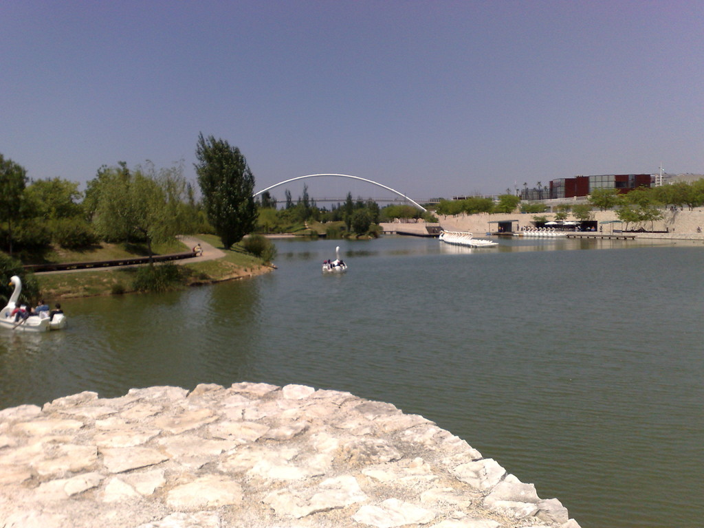
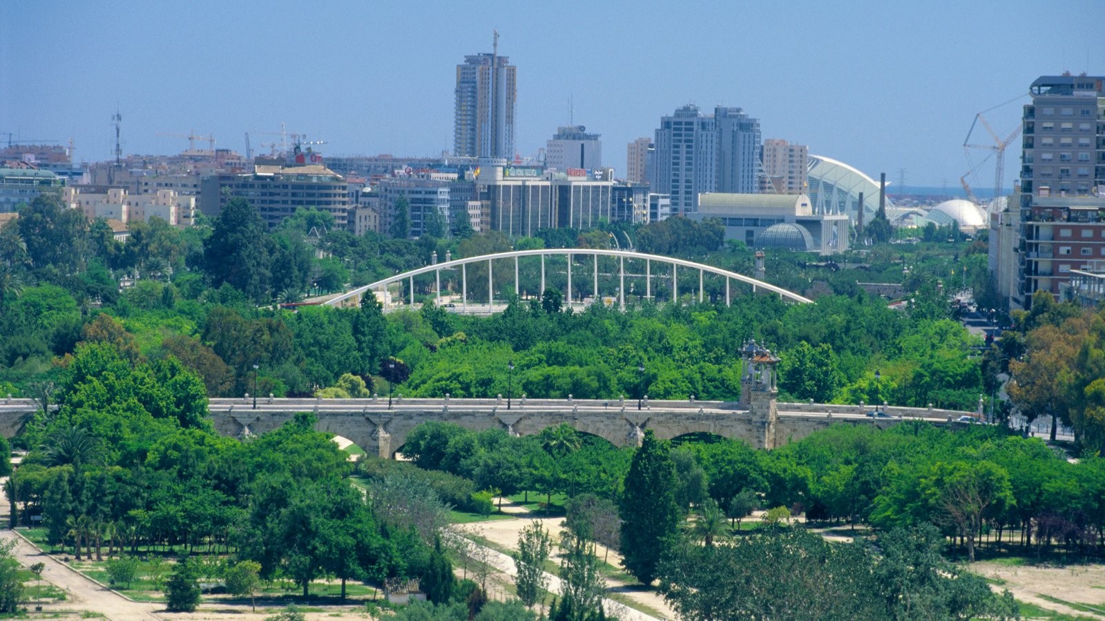
Fortunately, the 8km stretch of former riverbed was turned into a riverside park, which ends in the area of the City of the Arts and Sciences, and also goes through the Gulliver park and various sports fields. As you walk along the former riverbed, you'll see the majority of Valencia's bridges.
This path is, without a doubt, a favourite spot for the citizens of Valencia and you will soon know why.
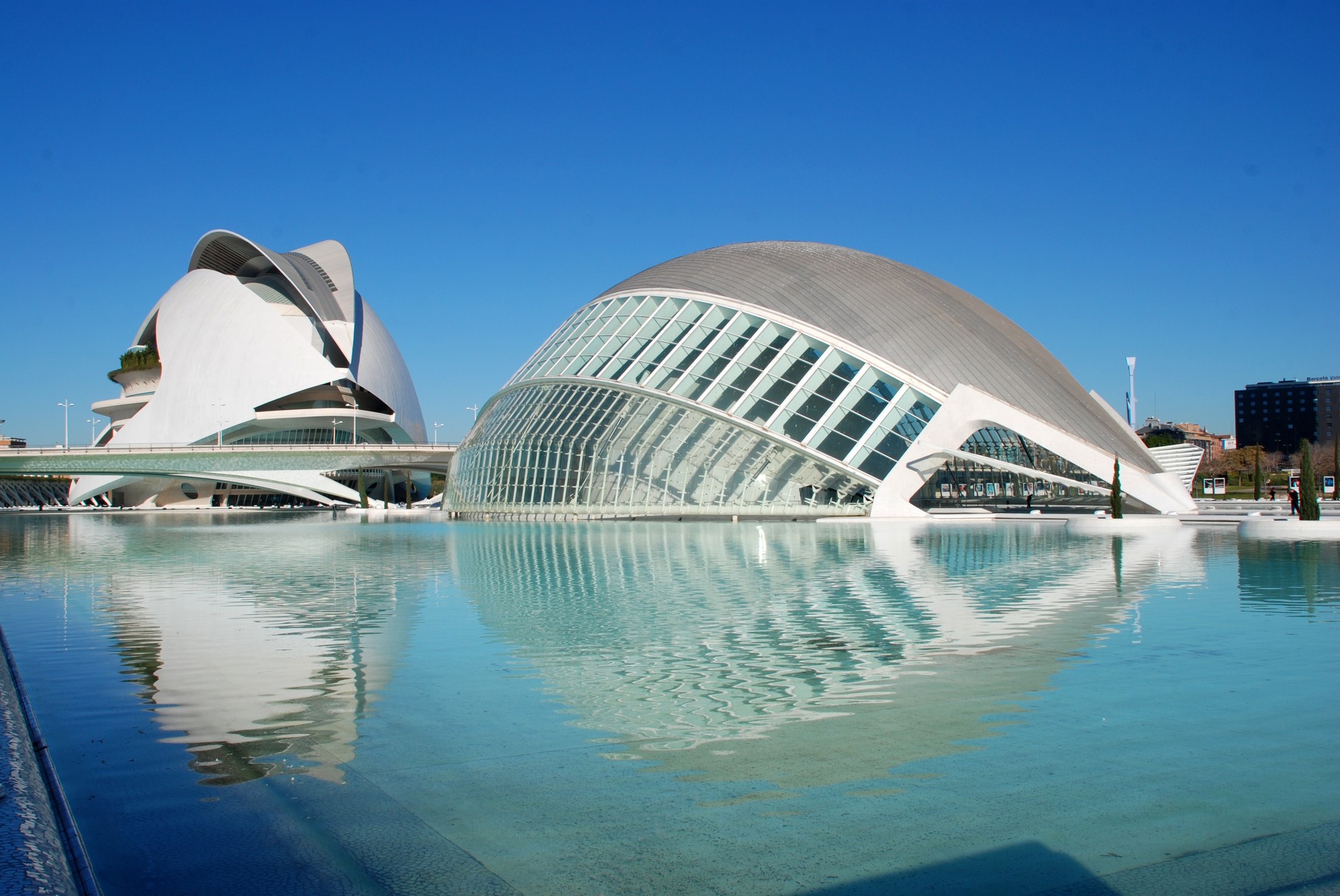
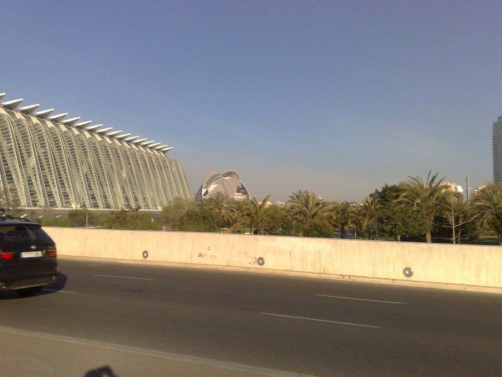
The City of the Arts and Sciences
Source
The old riverbed of the river Turia
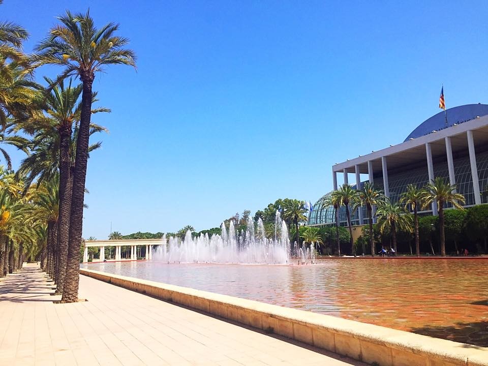
We start off near the bike path, close to the Assut de l'Or Bridge (called 'Pont de L'Assut de l'Or' in Valencian) and the buildings which make up the city of the arts and sciences.
As you can see, if you come to the end of the park, several kilometres of the path (3 or 4 km) still haven't been constructed; you can see this section very well from Nazaret Bridge, one day it will be completed, but until then we will start at the l'Assut de l'Or Bridge.
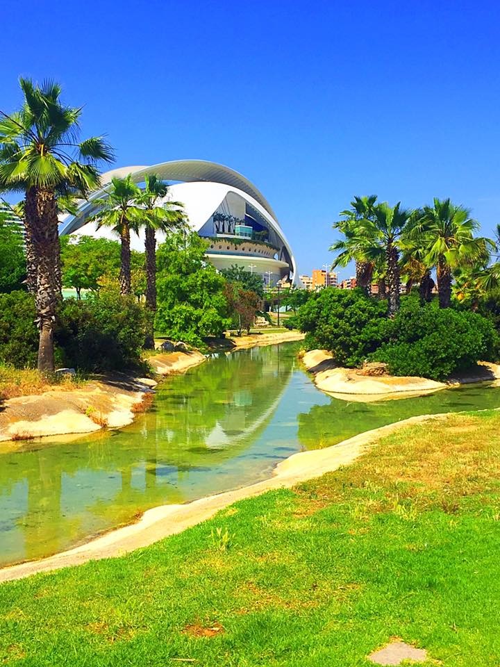
First of all, we have the Oceanographic Museum, which was opened in 2002. There's also the Ágora, opened in 2009. The Oceanography museum is a large aquarium, the biggest in Europe and well worth a visit. The Ágora is a purple building which at the moment doesn't really have a use, although you are able to go inside.
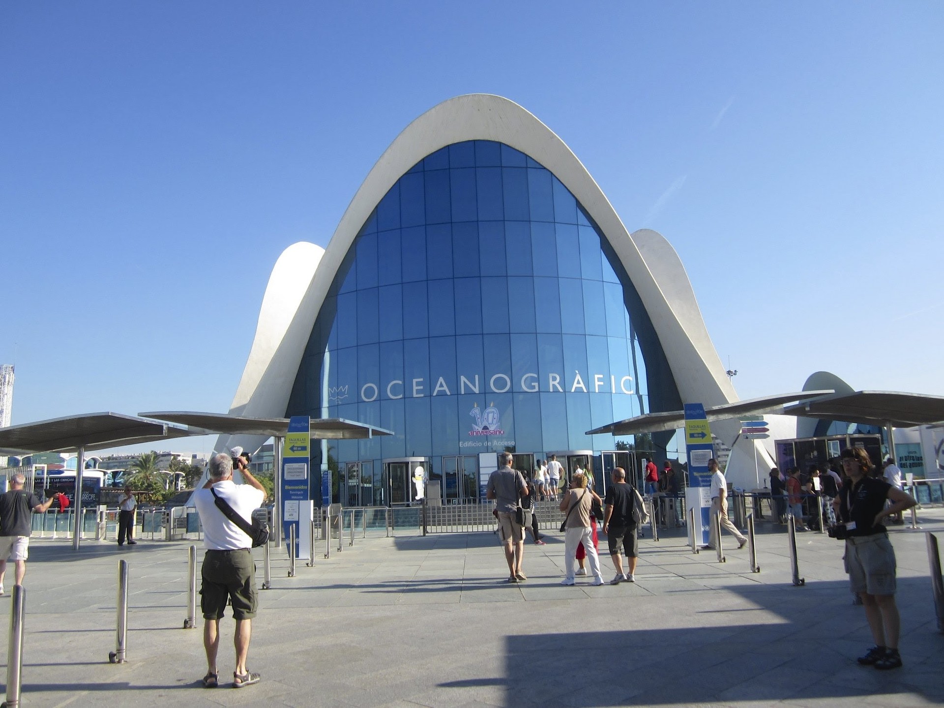
The Oceanography Museum
Source
Just next to that we have the l'Assut de l'Or Bridge. This bridge is better-known by its nickname 'Jamonero' or 'Puente dle Arpa' (Harp Bridge). Us Valencians often give things nicknames. The bridge's original name was given due to there still being a dam next to it.
The bridge is 180 metres long and cost around 60 million euros; it opened at the end of 2008. It has a cycle lane on which you can get to to the beaches in the south side.
Without a doubt, the worst thing about this bridge is not how much it cost (which is normal for a bridge of this sort), but the fact that it's not straight. As a result of it not being straight, you can't see cars well and them not following the Roman idea of a straight bridge has cost the life of more than one person.
On the other side of the bridge we have the Príncipe Felipe Museum of Science, which was opened in 2000 and serves as a science museum. And next to the museum is the Hemisféric, which acts as a concave cinema, and was opened in 1998.
We also have the Reina Sofía Palace of the Arts, which is situated between the Hemisféric and Monteolivete Bridge (known as Pont de Monteolivet in Valencian). This bridge is the work of Fernández Ordónez and extended by Santiago Calatrava.
It's a modern bridge, which doesn't stand out much, aside from its views over the old Turia riverbed. Something which should be appreciated is the fact that it is made up of two completely different styles of bridge.
The Reina Sofía Palace of the Arts was opened in the year 2005 and is used as an opera theatre. The various elements which make up the City of the Arts and Sciences will be discussed in a future article.
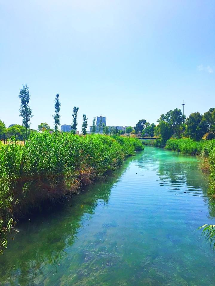
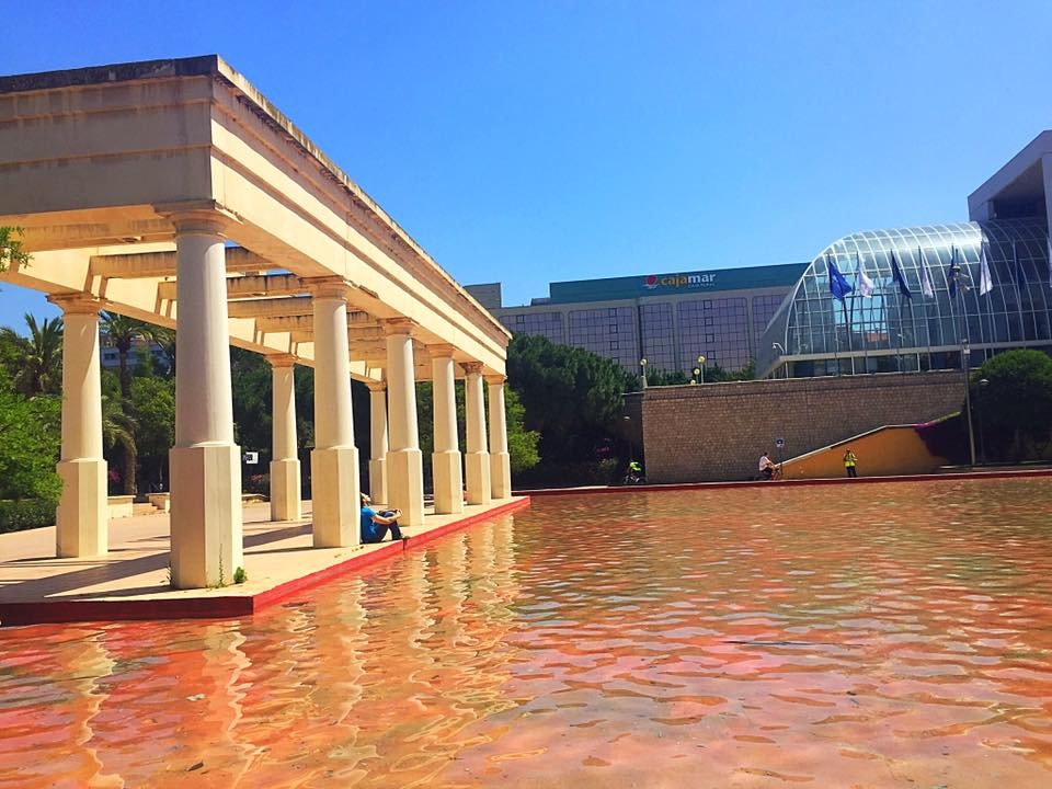
As for the garden in this first part, you will find a small stream, which is water from the Turia river. Whilst cyclists do use our bike lane, it's better to just stay on it the whole time, as every few kilometres you will come across someone keeping an eye on it. The lane goes two ways so that you have one for going both there and back, but in this part they only have lane, going in one direction.
I would also like to mention the small lake, which you can see in the first photo along with the Palace of the Arts, next to one of those abstract monuments.
We continue pedalling until passing underneath the Reino Bridge, (or 'Port del Regne' in Valencian), which was completed in 1999 and it is in this place that the Valencia to Barcelona train passed by, and although it's called Reino Bridge, it's also referred to as the 'Bridge of the Gargoyles'.
It was designed by architect Salvador Monleón Cremades. What most draws in the viewer's attention are the four gargoyles made by sculptor Juan Martí, which act as the 'bridge's guardians'.
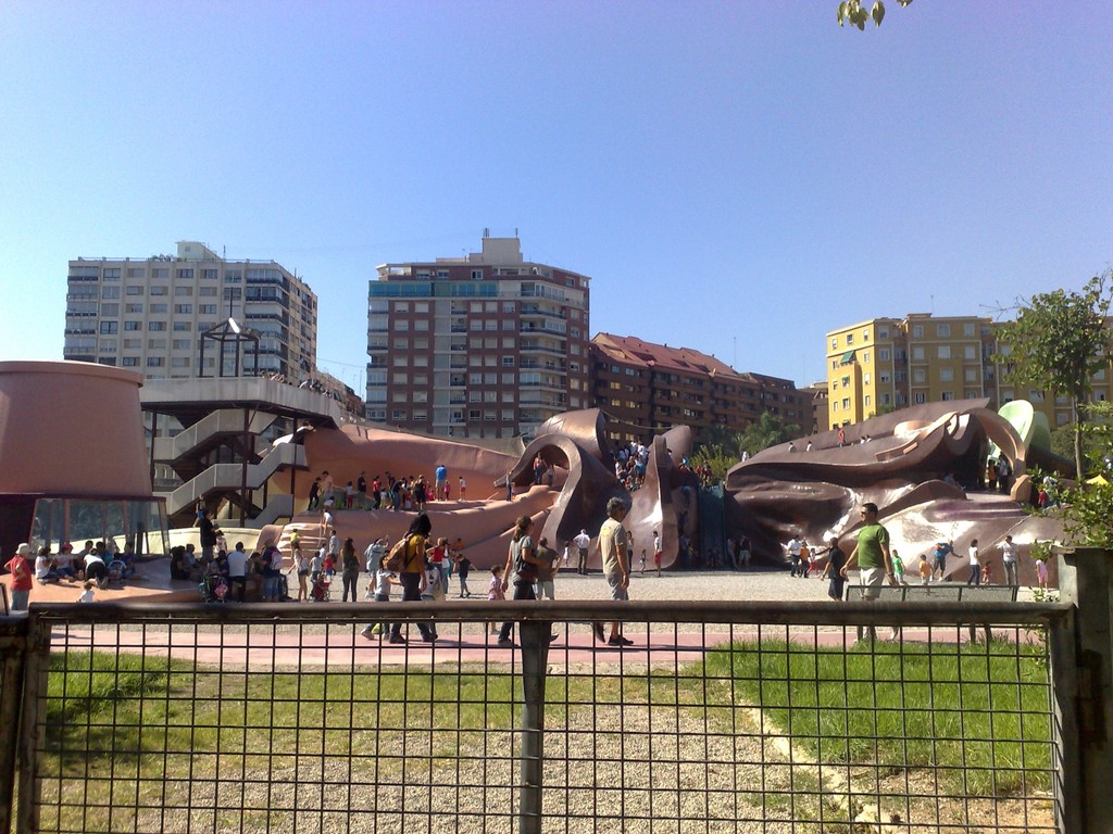
Passing by the bridge we come to Gulliver, which is based on the character in the Jonathan Swift book. It's a small park for young children which comprises of a giant figure of Gulliver but at the same time this figure has slides, places to explore...it's every child's (and non-child's) dream. This place does have opening hours but it's completely free to enter.
On the other side of Gulliver we have the Ángel Cusodio Bridge (or 'Pont de L'Àngel Custodi in Valencian), which links Peris y Valero avenue with that of Eduardo Boscá. It opened between 1941 and 1948 and was extended in 1967. It was an engineering feat of Arturo Piera. The bridge itself doesn't stand out as it's made of concrete, the only thing that does are the streetlamps, which looks like something from another century.
If I am not mistaken, it after this bridge when the bike lane splits into two, ideal for going there and then back. Although by now we're no longer in the City of the Arts and Sciences, there's another famous building here; the Palace of Music (Palau de la Música in Valencian).
Opened in 1987, it is home to the Orchestra of Valencia (not to be confused with the Orchestra of the Region of Valencia) and in this building, apart from musical auditions, exhibitions, conferences, shows and even some film screenings take place.
Here we have a nice, straight line which takes us towards the Aragón Bridge (or Pont d'Aragó in Valencian). This bridge was opened in 1933 and links the street Gran Vía Marqués del Turia with Zaragoza square. It was constructed by Arturo Monfort, Jośe Burguera and Gabriel Leyda On this bridge, the most striking thing are the sculptures which you can see on both ends of the bridge and were restored in 1967.
Next to Marqués del Turia street, there is a sculpture depicting a farmer (agriculture) and another representing wisdom. There's also one next to Zaragoza square, depicting a fisherman and another of a Valencian woman.
Continuing straight ahead, we reach the Del Mar Bridge (Pont del Mar in Valencian), as crossing this bridge historically leads to the area of Grao (the coastal zone). It is one of the oldest bridges in the city as it was built between 1592 and 1596 and is the work of the architect Francisco Figuerola.
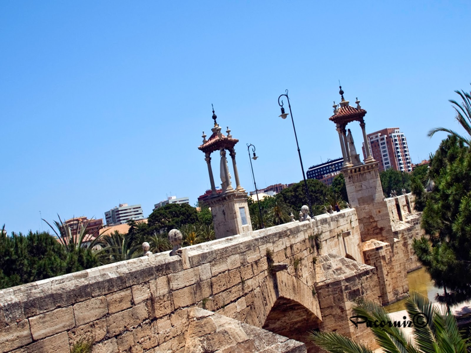

Del Mar Bridge
Source
The bridge originally had the image of saints on it, but this changed over the centuries as a result of successive floods that damaged the bridge. The present saints that can be seen are those of San Pascual Bailón, done in 1943 by the sculptor Jose Ortells López; and that of the Virgin of the Forsaken, from 1946 and made by the sculptor Vicente Navarro Romero.
Between 1933 and 1935, the architect Javier Goerlich Lleó added two large staircases and made the entire bridge pedestrianised, making it the only one apart from the Serranos bridge to not allow cars. This architect was already named when we reviewed the church of St. Agustín and St. Catalina.
An important detail about the reservoir, a kind of small lake that surrounds part of the bridge, which gives it a greater beauty.
Close by to there, there is the Flores Bridge (Flowers Bridge, or Pont de los Flors in Valencian), which, as its name suggests, is covered in flowers. It was designed by Santiago Calatrava and was opened in 2002. The reason for it being adorned with flowers is that flowers are mentioned in Valencia's hymn; there's a line which says 'Valencia is the land of flowers'.
The bridge itself is nothing special, but the flowers give it a nice touch.
Flowers Bridge
Source
Continuing along, a bit further along we have the Exposition Bridge (or Pont de l'Exposoció). This bridge was built in 1909 in honour of the Regional Exposition of Valencia, of the same year, in which the city gained numerous new pieces of art.
Sadly, the bridge vanished with the flood in 1957. It was replaced by a footbridge but it wasn't until the 90's, between 1991 and 1995, that a new bridge was constructed by Santiago Calatrava. It was also given the name 'Pieneta'.
Next to this bridge we have the Alameda metro station, designed by the same Santiago Calatrava, pretty but quite expensive to build as is normally the case with Calatrava's works.
Straight ahead we come to the next bridge, Puente del Real (or Pont del Real in Valencian). It has been around since the 14th century although it may well have existed before this time. The current bridge here was completed between 1595 and 1599. The original architect was Joan Pasqual, although there were other architects involved at the start.
In each part, the figures of San Vicente Ferrer and San Vicente Mártir can be seen, which were originally put here in 1603. The Spanish Civil War destroyed them, so new statues were added in 1945 and 1946. That of San Vicente Ferrer was done by the sculptor Carmelo Vicente Suria and that of San Vicente Mártir was done by the sculptor Ignacio Pinazo Martínez.
The bridge was extended in 1966, by the engineer Alberto Oñate, following the flood of 1957. This extension increased the bridge's width. Next to this bridge we have the Jardines del Real, which are not bad at all to quickly visit.
Continuing ahead we get to the Trinity Bridge (or Pont de la Trinitat in Valencian). This is Valencia's oldest bridge, built between 1401 and 1407, although it underwent a rebuilding in the 16th century after a flood. It's called the trinity due to it being close to the Trinity Monastery. It's also called the 'Catalan Bridge, as this part housed the resettlers from Lleida.
Currently it has two statues, one of St. Luis Bertrán, from 1693, and one of Sto. Tomás de Villanueva, from 1694, both the work of Italian sculptor Jacobo Antonio Ponzanelli.
Strangely, these statues belong on the San José bridge, but in 1906 they were taken away and kept at the Valencia Museum of Fine Arts (which can be found next to here). They were taken from the museum and put back on this bridge in 1942.
Close by, we have our next bridge, the Wooden Bridge (or Pont de Fusta in Valencian). This bridge as such was built in 2010 and 2012 by the Valencian architect José María Tomás Llavador, after the Serranos Bridge became pedestrianised. It's a plain bridge, nothing out of the ordinary, made out of concrete.
So why is it called 'Wooden Bridge' if it's made out of concrete? Originally, there was a wooden bridge here, which provided access to the Puente de Madera metro station, and the bridge ceased to exist after the flood of 1957. It was rebuilt, this time out of concrete but it remained just a small footbridge.
As Serranos Bridge is pedestrianised, they decided to build a new bridge in its original spot for to serve the traffic which would have originally gone on the Serranos bridge. And beside this, he added a small wooden walkway, which justifies the popular name.
And next to this we have the Serranos Bridge (or Pont dels Serrans in Valencian). This bridge is in front of the Serranos port, which is the only port that has survived, together with the Cuart (or cuarte) port. The name 'Serranos' originates from the fact this door is the one that transported the Serranía of the Kingdom of Valencia.
This bridge opened between 1518 and 1550, and is by architect Juan Bautista Corbera. In the 19th century it was extended along the right-hand side, and had a large garden added, which goes by the name of Alamedita de los Serrano and it leads to the next bridge. In 2012 it became totally pedestrianized like the Del Mar Bridge.
Originally, it had a series of statues, but during the War of Independence, they were thrown in the river before the advancement of the French troops, so that the spaces where they were could be used to place artillery. Currently it has no decoration.
In this part of the old riverbed it can be noted that it passes close by to the Old Town, so as a tourist it's a good idea to visit this place in the morning and evening so you can take a little stroll along the river.
Little by little we get closer to our next bridge, the bridge of San José (or Pont de Sant Josep in Valencian). It is believed that originally there was a wooden bridge here during the late 13th centruy. But the current bridge was built between 1604 and 1608 by the architects Jerónimo Negret and Sebastián Gurrea.
The name San José comes from the nearby convent of San José (which still exists today) and the San José Gate, which was destroyed in 1868.
As I said earlier, there were originally two statues here, dedicated to San Luis Bertrán and Santo Tomás de Villanueva. Nowadays, you can find a sculpture dedicated to San José, from 1951, by Octavio Vicent. As indicated in the article about Las Fallas, San José is the master carpenter at the Fallas festival, and this is the reason for the sculpture of him.
At this part of the old riverbed of the Turia river, you will find rugby and baseball playing fields, as well as grounds for other sports. Up ahead we have the Bridge of the Arts (or Pont de les Arts in Valencian). This bridge was built at the end of the 1990's by the English architect Norman Foxter. It's notable for its great streetlights but the comparisons are odious if we compare them with previous bridges. I am of the opinion that these famous bridges are all smoke and mirrors.
Moving along towards the Ademuz Bridge (or Pont de Ademús in Valencian), previously called the Glorias Valencianas (or les Glòries Valencianes in Valencian). It was built in 1968 by the Riojan architect Carlos Fernández Casado in order to make entry into the city easier for people living in the inland regions, such as Rincón de Ademuz.
The Gran Via Fernando el Catholic joins with the Ademuz Motorway. In itself it's nothing special. Also note that near the bridge is the Turia metro station.
After passing a running track (obviously on one side and not on the path itself), we arrive at Campanar Bridge (or Pont de Cammpanar in Valencian).
It was originally built between 1931 and 1937, linking Pérez Galdós avenue with Maestro Rodrigo avenue. The reason for its construction was to link the small town of Campanar with Valencia, although nowadays it's actually a neighbourhood which is a part of Valencia. After the flood of 1957, it was rebuilt in 1958 by the county architect Arturo Piera, who I have mentioned before. It's a normal bridge, nothing striking about it.
Finally we get to our final bridge Nueve de Octubre Bridge (Ninth of October or Pont del Nou d'Octubre in Valencian). It was built in the 1980's by Santiago Calatrava, and was one of his first works.
In short, we have a series of abstract elements that seem to represent an eagle and the center of the bridge is left clear, as if it it made up of two "small bridges" in each direction. The name 'Ninth of October' is because it is the day that Jaime the First conquered the city of Valencia, making it a day of celebration for the city and for the rest of the Valencian Community.
From the Astilleros Bridge found in Nazareth, there are about 17 bridges on this route along the old Turia riverbed. Finally we reach Cabecera Park where you can relax after a visit to the bridges.
Cabecera park marks the end of the route, at the end of which there is Bioparc. Bioparc is a zoo which used to be located elsewhere, until it was moved to this part of Valencia in 2008. I have not gone myself but people that I know say that is not bad, the entrance is worth the 20 euros, which is very expensive for a zoo.
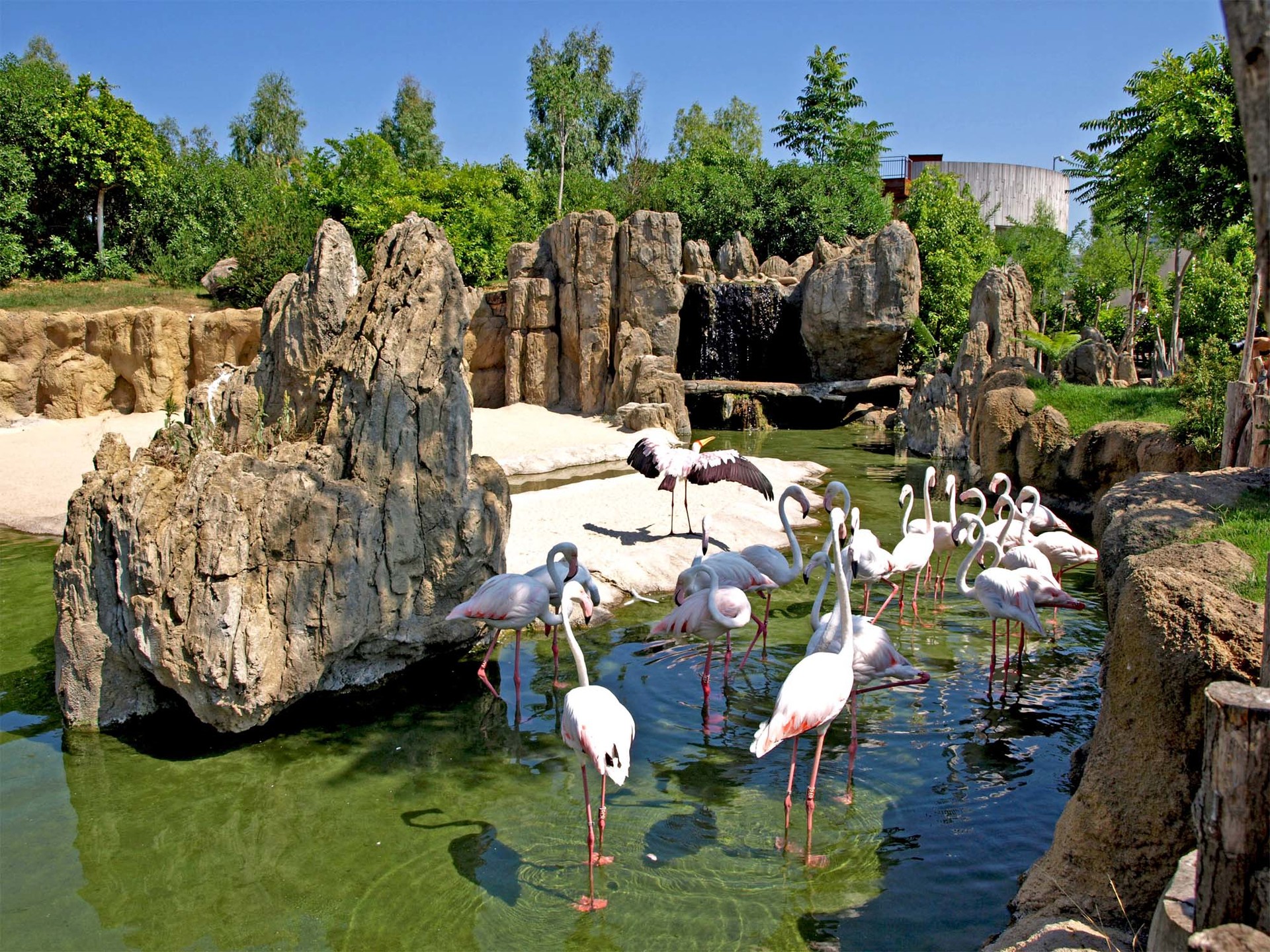
The Bioparc
Source
You can carry on for a few kilometres more, but by now we are already at the end of the municipality of Valencia, heading towards Mislata; the road carries on to Ribarroja del Turia which also has a metro station that was recently opened.
I recommend going both there and back in order to get a good look at all the parts of the old Turia riverbed, and especially if you're not in a hurry, enjoy the scenery.
In conclusion, I feel that this is an obligatory visit for everyone who has come to visit Valencia. The bridge's histories are fascinating but you can also walk under them and in the process discover every corner. Plus, the City of the Arts and Scienes is beautiful and there are other sights to see such as the Palace of Music and Bioparc.
It's no suprise that everyone ends up loving the old riverbed of the Turia river, Valancia's great riverside garden. I highly recommend visiting, whether you're a tourist visiting for the day or an Erasmus student in the city.
Source
 What to see Valencia,
Valencia,
Spain
What to see Valencia,
Valencia,
Spain


