Valencia and its cycling routes
In this post I am going to talk about Valencia and possibly one of the best known bike paths, the Churra Way and its "sister path", the Augusta Way. Although I love hiking trails, I have already talked about several of them, such as the Levada, in Funchal, Madeira or the other path I walked, Vall de Gallinera, in Alicante.
Valencia has a number of unique characteristics, making it a good place for cyclists. First of all the temperature, with the exception of a hot day in July or August or a cold spell in autumn, is perfect for cycling or hiking almost everyday.
Secondly, the city of Valencia itself - Valencia is not like Madrid, or like my beloved Coimbra, which are full of hills. On the contrary, it is a city practically completely flat, which is perfect for cycling.
And last but not least, is the number of routes which are available. Valencia is not my city, my city is Gandía which also has the first two of these characteristics, however, in Gandía, there are hardly any paths or bicycle lanes to get from one place to another. In fact, there are only two, a 10 km route to Oliva along an old train track, and another much smaller one that allows you to visit Ullal del Duc and the Marjal, and you can also go to the beach in Gandía.
In Valencia, however, there are many cycling routes. There are several linked on a map in a page of the newspaper Las Provincias that I have linked in this article but there are other pages like Wikiloc. At first this was very useful because I didn't have a helmet so I wasn't allowed to go on the road. Now I have actually bought one, but it is always interesting and safer for cyclists to keep off the road.
The Churra Way
The churros is a name for the inland regions of the Valencian Community, whose main language has always been Spanish. Here there was a greater number of the Aragonese population that ended up assimilating Spanish.
There are regions such as Rincón de Ademuz, Los Serranos, Canal de Navarrés, Alto Palancia, Alto Mijares and Hoya de Buñol. Although it normally focuses on these regions, the Churra Way links Valencia with Calatayud, in Aragon and it got its name from the Aragonese.
Valencia is linked to the north by two lines, one bulit by the North Company that links Valencia to Castellón and Barcelona, and another, the chosen Churra Way constructed by the Aragon Company that links Valencia with Calatayud.
Obviously the first one was much more profitable when linking people to the coast and for that reason the second one was dismantled during the '70s, although it wasn’t completely dismantled until 1985. When the train was dismantled, part of the old route was kept and this is the stretch between Valencia and Meliana, which I will talk about later.
The Augusta Way
The Augusta Way was one of the great "highways" of the past - more exactly of the Roman Empire, and it gets its name from the emperor, Augustus who made some repairs on the road. Originally, the Augusta Way linked Narbonne, in France, to Cadiz, passing along the Mediterranean.
It is interesting to see how certain parts of the route are still used, although now under the asphalt of a motorway, including the AP-7. In this post, when referring to the Augusta Way, we are not referring to all those kilometres between the two cities, but to the one marked between Meliana and Puzol. There is also a third section - a bit of road that connects Puzol with the city of Sagunto.
The bicycle path
We will start in Valencia on the Catalonia Avenue, near the Vera way. There is a large roundabout that connects large avenues such as Aragón, Benimaclet and the Polytechnic and Naranjos campuses (the campuses of the University of Valencia).
The only complicated thing at the beginning is to find the way. As I already mentioned when I crossed the Levada in Funchal, it is a good idea to take with you a map, either printed or on your mobile, or if you have one, a better GPS. I use a map as a guide, but I understand that it is better to use a GPS.
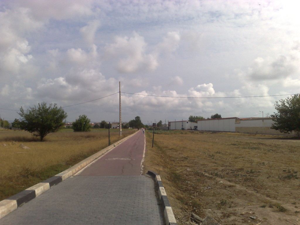
The first image of this post is the beginning of the route. Although this route is made for cyclists, there is a much shorter route (for example stopping at Rafelbuñol or Meliana) which can be done walking.
The beginning links Valencia to Alboraya, possibly the most beautiful part. Here you realise the reason why Valencia is in the region of “l’Horta". The time of the year when I visited, June was a good time to observe the green fields of the tiger nut, along with the horchata (milk-like beverage made from nut grass), which is undoubtedly the most typical Valencian drink.
Drinking an horchata in summer, is like the paella of Sundays or the Fallas in March, something very typically Valencian.
A light tour will take us to Alboraya. Alboraya with a little more than 23, 000 inhabitants according to the INE of 2014, has become a dormitory city along with others like Torrente or Burjasot. While in most cities during these five years the number of inhabitants has decreased, in Alboraya it either grows or remains the same.
The patrimony of Alboraya is its orchard and numerous hermitages distributed by the different lots of orchards. In addition to the important tigernut, its watermelons, melons and vegetables.
Alboraya will be the only village together with Puzol and the Port of Sagunto in which we will enter in the own helmet of the city. We will go along the bicycle lane and we will only see the remains of the Roman bridge "de los Moros". One can deviate to observe the Church of the Assumption, from the XVIII century.
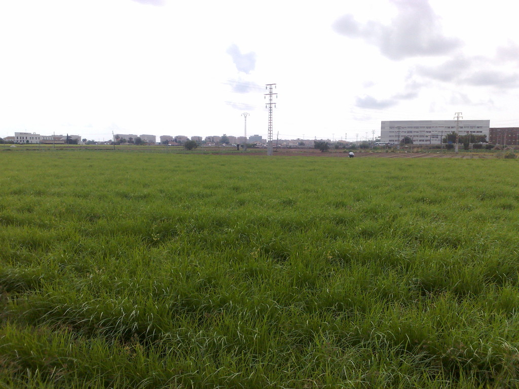
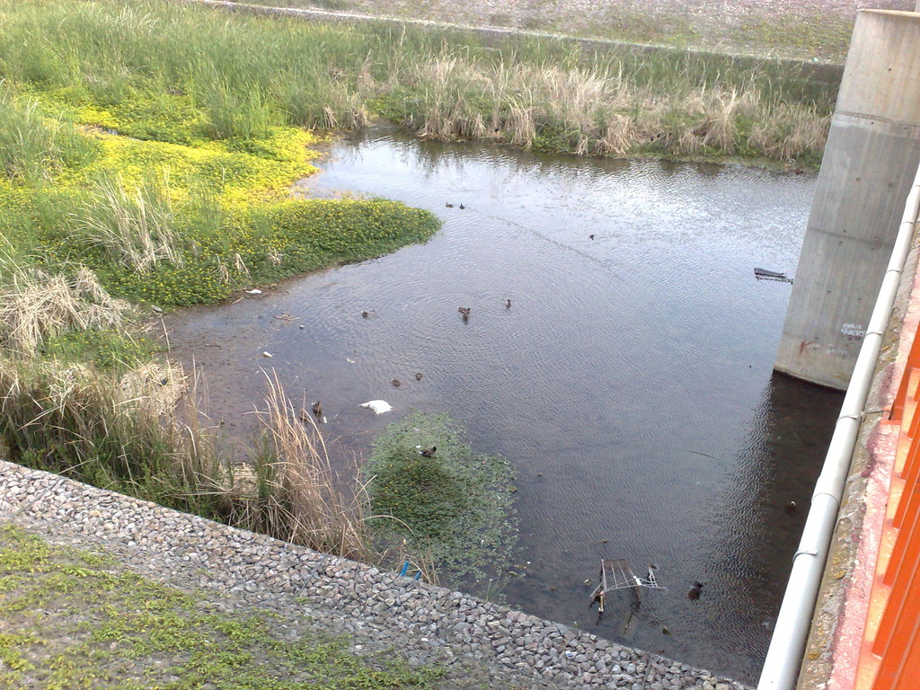
Little by little, we will cross the city and we will arrive at the end until reaching the barranco del Carraixet. The truth is that from the Carraixet ravine I expected something more, it is a simple ravine, quite ugly but for the inhabitants of Alboraya has its importance.
It was important due to the floods of 1949 and 1957, because it feeds on spring water. There are different flora and fauna in it, although I did not see anything of the other world in that ravine.
If you want to know more about horchata, you can take a detour to the right of the Carraixet ravine and arrive at Port Saplaya where there is a museum dedicated to such good food.
Passing the Carraixet ravine we arrive at the orchard of Almácera (or Almàssera in Valencian). Almácera has just over 7, 000 inhabitants, just like Alboraya grew as the dormitory city of Valencia. Even so, there is still a little vegetable garden where one can see tiger nuts, artichokes or potatoes.
From the village, the only outstanding thing is the church of the Holy Sacrament, its interior is nothing of the other world but I found its façade quite beautiful.
This part of the orchard is quite good because it has a shaded picnic area, here I took advantage to rest and eat something. After the picnic area you reach the end of the Via Churra that ends in the municipality of Meliana.
According to the INE of 2014, Meliana has more than 10, 000 inhabitants and it is curious that it is the municipality of the Valencian Community with a highest GDP per capita. In Meliana, the church of Santos Juanes stands out from the 16th century Renaissance, although it has some Valencian tiles from the 17th century.
Also interesting is the Palace of the Nolla, a modernist building that belonged to a tile businessman and now belongs to the city council.
In Meliana one can turn off on two roads, continue along the Via Churra, turning to the right and passing through Albuixech and Masalfasar, or continue straight ahead on the Via Augusta and go through the municipalities of Foyos, Albalat dels Sorells, Museros, Puebla de Farnals and Rafelbuñol.
I will explain the second route, leaving the first one for a future article that will explain the route between Valencia and the Marjal de los Moros.
We leave the Via Churra following straight the road and we will enter by the Via Augusta, Meliana we cross it quickly (unless we see the church and the palace) and soon we will enter the municipal area of Foyos. In this part of the bicycle lane we will no longer enter each city but the bicycle lane will communicate with the periphery of the different dormitory cities.
Foyos has 7, 000 inhabitants according to the INE of 2014. It stands out for the church of the Assumption of Our Lady. Built at the end of the 18th century, its interior has baroque altarpieces and neoclassical paintings. The bicycle lane is not in the municipal area but one can easily deviate.
Along with Foyos is Albalat dels Sorells. Albalat dels Sorells has almost 4, 000 inhabitants. De Albalat dels Sorells stands out for the Church of the Saints Kings, carried out at the end of the 18th century.
On the other hand, to emphasise the Palace of the Sorells, nowadays it has municipal dependencies but it is one of the most interesting buildings of the route, realised at the end of the 16th century it housed the residence of the Sorells, some nobles that gave name to the municipality. It passes almost to the edge of the village, as in Foyos, if we want to visit it, we must deviate from the path.
Next we find a curious town or village, Emperor. Emperor is one of so many villages surrounded by another bigger city for example, Gandia covers Benirredrá. But apart from the fact that Emperador is covered by Museros, Emperador is the smallest town in Spain, it has only 0, 0306 km².
It has almost 700 inhabitants according to the INE of 2014. Because of being so small it does not have great patrimony. It has grown in recent years by a housing development which has exhausted the urban land of the municipality. The only outstanding thing is the hermitage of the Virgin of the Rosary, in whose interior is a painting of the Virgin of the Rosary carried out in the '20s.
The next place is Museros. Museros has more than 6, 000 inhabitants according to the INE of 2014. Its population lives mainly from the service sector although there is some industry, the little agriculture focuses on oranges and vegetables. Museros's highlights are: the Masía de San Onofre, a former convent, and the small Ermita de San Roque, quite simple. In Museros we will not go inside either, but we will border it.
From Museros and Emperador we will find a conurbation, that is to say, of colloquial form "stuck cities" or together that includes Emperador, Museros, Masamagrell, Puebla de Farnals, and Rafelbuñol.
Next we will find Masamagrell (or Massamagrell in Valencian) that has more than 15. 000 inhabitants according to the INE of 2014. Of its patrimony, the neoclassical Church of San Juan Evangelista, the convent of Santa María Magdalena from the end of the XVI century and a monument dedicated to father Luis Amigó.
The next one is Puebla de Farnals (or Pobla de Farnals in Valencian) with almost 8, 000 inhabitants according to the INE of 2014. La Puebla de Farnals is divided into two parts, the beach and the city itself. Of its heritage we highlight the Casa del Pueblo, seat of the town hall and the San José Church of the eighteenth century although reformed in the nineteenth century, inside there are paintings of the seventeenth and eighteenth century.
If you access the beach, you will find the Church of the Virgen del Carmen, made in the '70s.
In last place we will arrive at Rafelbuñol (or Rafelbunyol in Valencian) which has almost 9, 000 inhabitants. The economy revolves around the service sector although it has a lot of industry, small agriculture focuses on oranges.
From here we will leave the landscape of buildings and we will be surrounded by orange trees. At a given moment we can deviate to Puig de Santa María, we will leave it for another article. And we will arrive until Puzol.
Puzol (or Puçol in Valencian) does not have a metro as the other towns mentioned but has a closeness so if we are tired we can return to Valencia. It has a population of almost 20. 000 inhabitants, being the capital of "l'Horta Nord" (the "Huerta Norte").
Its majority population works in the services, but an important part is working in the industry being near Valencia but also in the industrial pole of the Port of Sagunto. Of the agriculture it emphasises the vegetable but above all one observes the orange trees that there are by its municipal term.
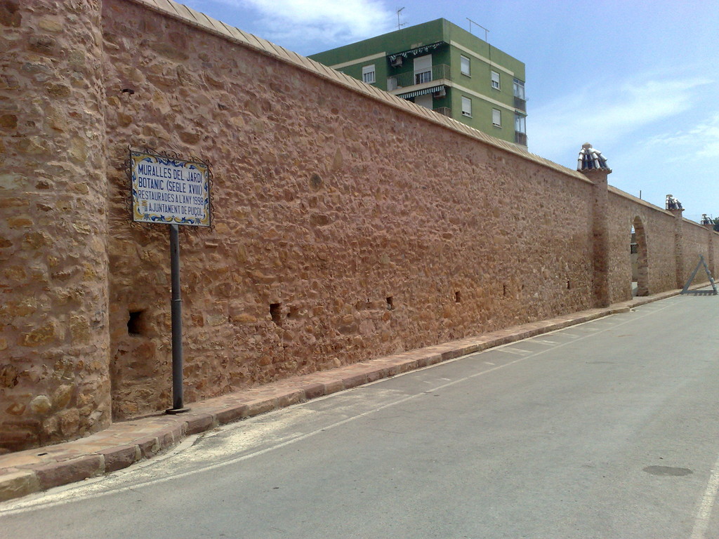
To emphasize the Church of the Saints Juanes realised in the eighteenth century, in its interior it lodges beautiful altarpieces. Next to the church, is the walled botanical garden, there was in Puzol an archiepiscopal palace of the seventeenth century whose previous was a botanical garden in which the peanut was cultivated for the first time in Spain. Unfortunately, only the remains of this wall can be seen in the photograph above.
Also named "the Torreta", built in the fourteenth century, its purpose was to warn of possible attacks on the population, is now a private home and can not be visited. Finally, to name the church of Santa Marta realised in the decade of the 60's, whose style is modernist.
From Puzol, we will find another double path. One of the roads takes you to the Puzol beach and from there visit the Marjal de los Moros, and from there you can go to the Port of Sagunto.
Another of the roads is to reach Sagunto (Sagunt in Valencian), it is advisable to take a map because at this point there is no good signage. Sagunto has a population of around 65, 000 inhabitants, although of these only 20, 000 belong to the city of Sagunto, since most of the population is concentrated in the Puerto de Sagunto.
Most of the population lives from the industrial sector of the Port of Sagunto itself. As far as Sagunto's heritage is concerned, someone can spend the whole day visiting it. The Roman Theatre which had a controversial restoration, the Sagunto Castle which is a mixture of Iberian, Roman, Arab and Christian styles should be highlighted.
Next, the Santa María church which began to be built in the 14th century but did not finish until the 18th century or the El Salvador church of the 13th century. And finally, name the various hermitages found throughout the municipality.
Once visited Sagunto, we will take the bicycle and our sore feet and we will be able to return to Valencia in the service of cercanías.