Let's continue once again exploring new places!
On this occasion, one of the best routes I know is the walk to get to Albufera in Valencia. In this article I am not going to explain Albufera in detail, but rather one of the routes you can take in order to get there, even though there are a few.
For those who do not know Albufera, it is a type of fresh-water lake. In the fields they cultivate the rice that Valencian people use in their paellas (or whoever we export the rice to).
Albufera belongs to the Municipality of Valencia, but the fields are divided into six or seven municipalities. It is marvelous to go and visit Albufera, but so it the rest of the route which goes through the beaches that belong to the last area of Valencia (except Perellonet).
How to get there
The truth is that the route can start from many different places, and you don't have to take my recommendation so you can start from another municipality, like Catarroja or Sueca. My idea, and recommendation, would be to start on one of the Valencian beaches like Cabañal or la Malvarrosa, or even from the beach Patacona.
You could also go on bicycle, but it is perfectly easy to do it by foot, although it is quite extensive and you would probably want to divide it up into a couple of days' trip. The route can be seen on various maps, like the one in the Province newspaper: : http://bicivalencia.lasprovincias.es/mapa-carril-bici-valencia/
The route
Let's start at the Patacona beach, on the seafront where the border between Patagona beach and Port Saplaya ends. The different, apart from them not being united, is that there is a water treatment plant in the middle of them.
Port Saplaya started to become a second residence location at the beginning of the 70's, while the beach Patacona was not until the 90's because there used to be a small industry there.
Another reason is the growth of Malvarrosa, which has just united with the Patacona beach and has only one administration difference. The Patacona beach is quite strange (and a little unfortunate) as the economic crisis left quite a few houses unfinished and so the seafront is quite ugly.
Let's continue straight on, by the bicycle route until we get to Malvarrosa beach. I am not going to explain the beach very much as I would like to speak about it in a future article. Without a doubt, it is the most popular beach in Valencia and the most accessible as it has the metro and the university on either side.
On this beach, the bike lane has stopped being useful and now is a bit useless, as it in put on the sand and when it is windy it gets covered. In high season, the police also walk there in twos or threes to annoy the cyclists. I see it as a bit stupid when there are other priorities and they could simply just fill it in with cement. In low season we can walk where we want.
Continuing on from the Cadena Canal, you can find the Cabañal or Arenas beaches, similarly to Patacona there is just an administrative difference between them.
I would like to explain this in another article, but I will highlight it now, the building of las Arenas, the advice is not to enter into it during the night if you like your mobile phone. Although, the beach is not dangerous, it has the same bike lane as in Malvarrosa and it has the same problems as it does there.
Our next stop will be the Port of Valencia. During the last few years it has been quite ugly, until 2007 when the 32nd America's Cup regatta race was celebrated in Valencia, before which they made a series of improvements, but a lot of buildings still remain empty. Luckily, during those two or three recent years, the port has been sorted out.
If you don't follow a map and you know the area well, you can get confused as the bike lane disappears suddenly. Our walk it towards Nazaret. Once you see the bike lane disappear, or even before, direct yourself to the Nazaret bridge.
Nazaret isn't one of the best places to go, on the contrary almost of the worst at the height of the Cabañal, don't go through here at night. When we pass over the bridge, there will be a bit of a pitiful view of the Formula 1 racetrack and we will be near the Arts and Science Museum, Museo de las Artes y las Ciencias.
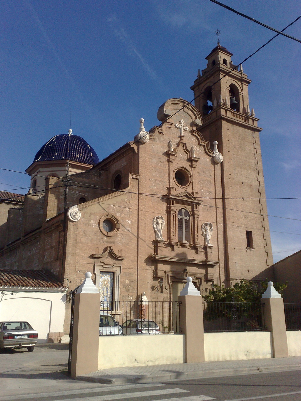
Our bike lane will soon become joined to the road but separate from the cars. If you can see the church below you, you're on the right track.

It is a path of old factories (there are several) this church is basically the last important building. A detail that I have forgotten is the use of the bike helmet, at least until you get to Albufera, since the bike path is separated from the road.
Following the bike lane we will arrive at two hills, the only ones on the journey and after passing by a bridge that goes over the new riverbed of the Turia river, we will be at the ports of the Pinedo beach where we will find the welcome sign for Albufera, the first picture in this article shows this.
We have done a small straight line and soon we will be at the Pinedo beach. The beach is 1, 500 metres long and the name comes from olden times when there was a "pinar", a pine, or a "pinedo", a group of pine trees. But in reality, there's nothing there.
Although the beach is urban, Pinedo is a town with a little less urban character. There are various restaurants on the seafront and the bike lane is useful here, not like in Arenas and Malvarrosa.
The next beach is the l'Arbre del Gos, I don't know the etymology. The beach is a lot more natural here, especially the final stretch. It has two. 600 metres of beach and there are sand dunes, saved after various urban damages made in the last decades of the 60s and 70s. There is also an orchard.
The bike lane does not turn to cement but more of a wooden path, sustainable with the beach. The beach finishes with the building that looks like a boat, the restaurant Arrosseria. This natural environment has created a mixed beach, with some bathers and at the far end, some nudists. However, the times when I have gone there, there haven't been any bathers because it was low season and it was cold.
The next beach is called Saler. It received its name from the old salt mines. The beach also has 2, 600 metres of space available but on this oocasion, we are going to walk next to the seafront, close to the bike lane. You can follow directly next to the motorway, but I recommend the bike lane more that leads to the seafront.

The bike lane will lead us through a small path full of trees, one of the first routes through Albufera proposed was less than a kilometre and was called the route of "sentidos", "meanings", where you can touch leaves and smell plants and see everything.
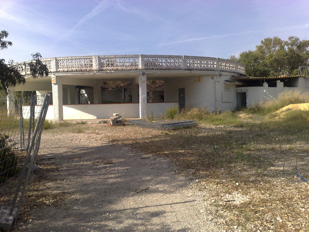
Throughout the walk there are various picnic sites, I once ate some here but you can also eat somewhere else. Continuing on, we are near the house development ports of Saler, but before that we must pass by the Venta del Saler, a picture of which you can see above.
Like the name suggests, it used to be a place to hold bulls when the plaza de toros was full. In reality (or at least during the times when I have visited there) it is abandoned and fenced, apparently there has been a few attempted robberies here.

After la Venta del Saler, we will arrive at the remains of the housing development of Saler. During the 60's there was not the same environmental knowledge that we have today, and so they made great destructive buildings on the Mediterranean coastline.
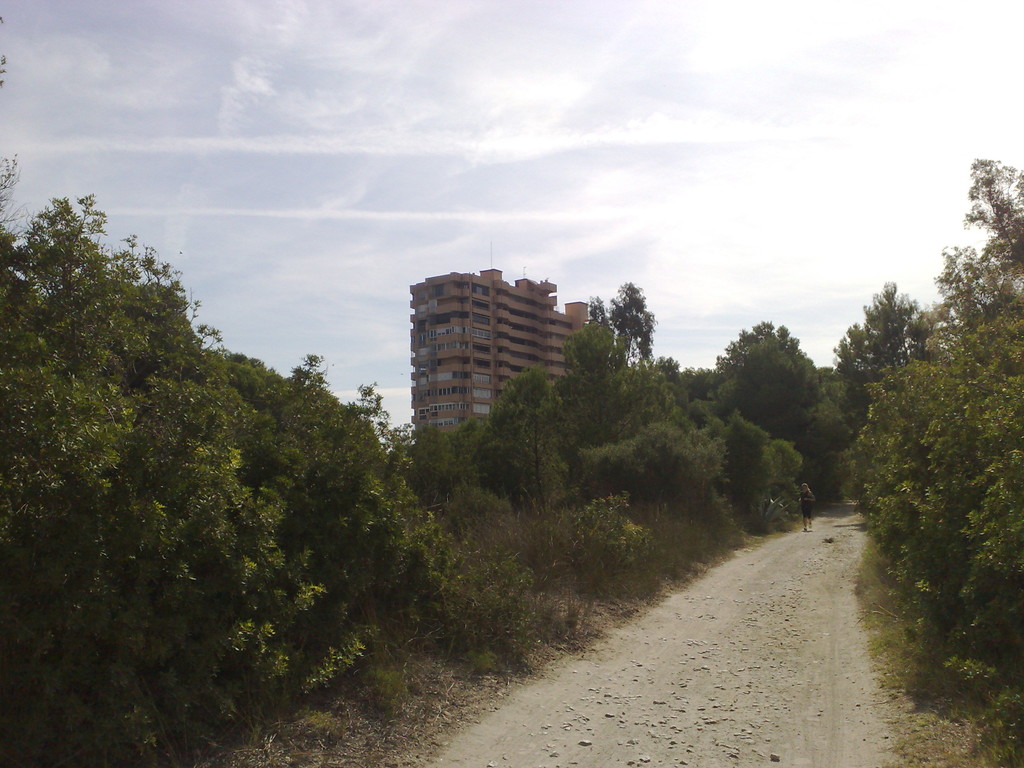
A perfect example is the urbanization of Saler, the idea was to construct a great big housing development on the seafront, destroying the environment around Albufera, a natural park. Luckily, they put a stop to it, but the work had been done with 4 or 5 buildings.
The bike lane brings us close to two of them, showing us also the foreign vegetation from Mexico, a strange plant. Although we are not entering the next beach, you could go there as an alterantive to these buildings, it is called the Garrofera beach.
Garrofera means a "locust tree", I suppose that in the past there was some of these trees that caused the name. It is a small beach that borders with Saler in the north and Puchol Nuevo in the south. It only has 1, 500 metres of space.
As we don't want to go to this beach, let's continue on the same bike lane (which in reality is a trail), in some parts it is difficult for bikes to pass but it is not too difficult.
We have almost arrived at the end, the path is basically walking on the Garrofera beach until you arrive at Puchol Nuevo, passing by some various "malladas" which are dips and depressions in the sand.
We continue straight on and we will come to an artificial lake, and despite it being artificial, it is still quite beautiful.
A sign tells us that it is better if we do not bathe in the water here and another tells us that Albufera was formed over many years. If we need water, there is a small fountain next to the lake (obviously artificial) where you can fill up your bottle to drink from. Here we have three option, return (without seeing Albufera which is a crime), go to Albefera, or go to the Devesa beach.
From here we have a new, totally natural beach (and therefore popular with nudists) surrounded by Puchol Nuevo to the north and Perellonet to the south, pine trees and vegetation, and practically 5, 000 kilometres of space.
Its name comes from the word "meadow", a field filled with vegetation. The pathway to the beach is asphalt so you wont have a problem getting there.
If, on the contrary, you want to go to Albufera, as we entered, go to the right from Puchol Nuevo and there is a small walk that you can take. There a lots of signs telling you interesting things about Albufera and even the remains of a tree that was burned in a fire a couple of years ago. You only need to cross the road and you will be able to see Albufera.
To return, you only need to do the same walk in reverse. If you know where, you can get the train from Sueca or Catarroja. To me, I love the way back as well since it is a unique place and it is so close to the city of Valencia. Although the other options are not bad at all.
In conclusion, this is a unique place and a little bit of paradise! Thank you for reading!
 What to see Valencia,
Valencia,
Spain


