Moving on from Portugal, to go on one of my favourite hiking trails, without a doubt my personal preference in the community of Valencia, the lovely Gallinera Valley.
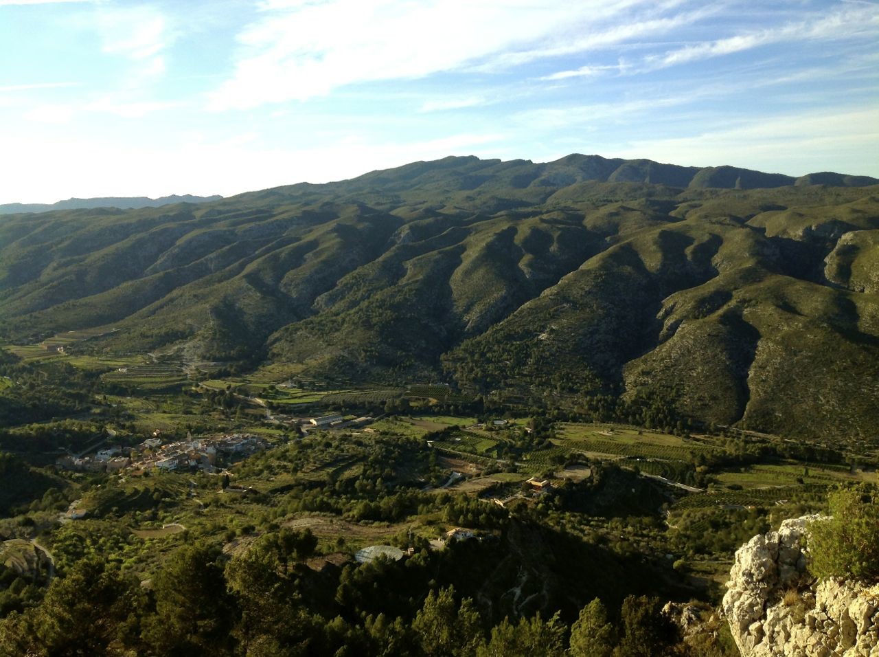
Gallinera Valley
Source
General infomation
Vall de Gallinera is a small town in the province of Alicante, in the region of Marina Alta. It can be found on the edge of the province of Alicante, so some of these hiking trails can be an interesting way to explore more that just one province.
With almost 600 inhabitants (according to the 2014 INE census), little by little, the municipality has become a small paradise for its 'ecotourism', there you will find cyclists, hikers or even climbers (the latter being a minority though), the first visitors to this alternative tourism site shaped more by nature than by visits to monuments or museums.
The Valley, bit by bit, has encouraged this type of tourism, on one hand, by creating what they call 'rural houses' and on the other hand, by preserving trails for tourists, the majority having become exposed to the area from the recommended book 'La Vall de Gallinera. Per camins de moriscos i mallorquins' (which translates to 'Valle de Gallinera. Through Moorish and Majorcan journeys'). In addition to this, the gradual opening of bars all over Vall de Gallinera has encouraged yet more tourism.
For these reasons, the population increased slightly in the first decade of the 21st century but due to the crisis and an aging population, in the last 3-4 years it has fallen slightly.
It would be wrong to speak about Valley as a single place, as the route below explains, Vall de Gallinera is in fact made up of 8 towns: Benirrama, Benialí, Benisivá (Benissivá in Valencian), Benitaya (Benitaia in Valencian), La Carroja, Patró (Alpatró in Valencian), Llombay (Llombai in Valencian) and Benisili.
Llombay has been uninhabited since the early 1970s and Carroja barely has any residents (with the people living there all being older than 60, sadly) so there are essentially 6 towns with people living there all year round. The town of Patró has the largest population and Benialí has the best public services such as a bank, a town hall and the largest school.
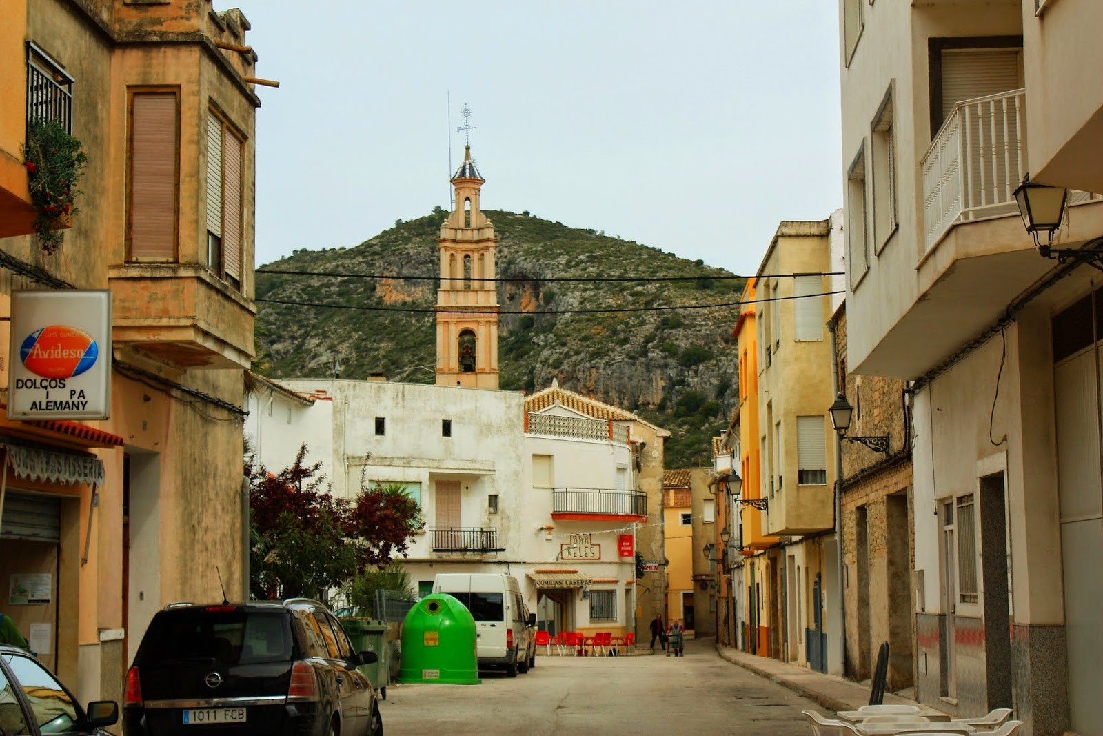
Patró
Source
How to get there
Sadly, due to the Vall de Gallinera's small population, the surrounding towns also having few residents (Planes, Adsubia, Valle de Alcalá, Vall de Ebo, Lorcha... ) and being far from big cities, there are barely any transport options other than car.
Situated 10km away, you can find the town of Pego, with more than 10, 000 inhabitants, making it the first port of call for the people of Vall de Gallinera when they need to access services not present in their town. For example, the high school is one of these places, as there are only primary schools in Vall de Gallinera, in the municipality of Benialí and Patró (the latter has only 3 or 4 children left, so it is said that in time it will shut, leaving only Benialí).
Off the top of my head I know that there was a bus with links to Alcoy but I do not know if it still runs or if there is just no information online (this wouldn't be the first time). There is also a bus service in summer which goes between Vall de Gallinera and Pego on Thursdays, as this is the day of Pego market, although in summer 2014 this service was not running and I have no clue if this is still case.
Aside from Pego, also in the province of Valencia you can find Oliva (home to almost 30, 000 people), and more importantly, Gandía (with almost 80, 000 inhabitants), whilst in the province of Alicante, aside from Pego that is, you have Denia (with 45, 000 residents). Denia is connected by tram to the rest of the province of Alicante, whilst Gandía with the rest of the province of Valencia (and Castellón) and the surrounding area.
It is possible to do the route by going by bicycle from Pego, as I am going to explain later on, but certain trails are not suitable for bikes and therefore, it is advisable to do it via the roads.
Saturdays and Sundays are the best days for cycling in Vall, you will find it full of bikes. I am of the opinion that so many bikes at once on narrow streets can be dangerous, so if you have the option to, it is better to go another day although of course if you only have the weekends free, it's better to choose a Saturday or Sunday than nothing.
For hikers, it is theoretically possible to do 10km from Pego on foot, but the 8 towns route is 20km long, making it 50km long if you factor in going there and back and returning to Pego, which is too much. It is better to start off by car and enjoy the tranquility of the 8 towns route. And if you have the possibility to take two cars, I recommend stopping one at the start of Benirrama and then another in Benisili in order to take advantage of the serenity.
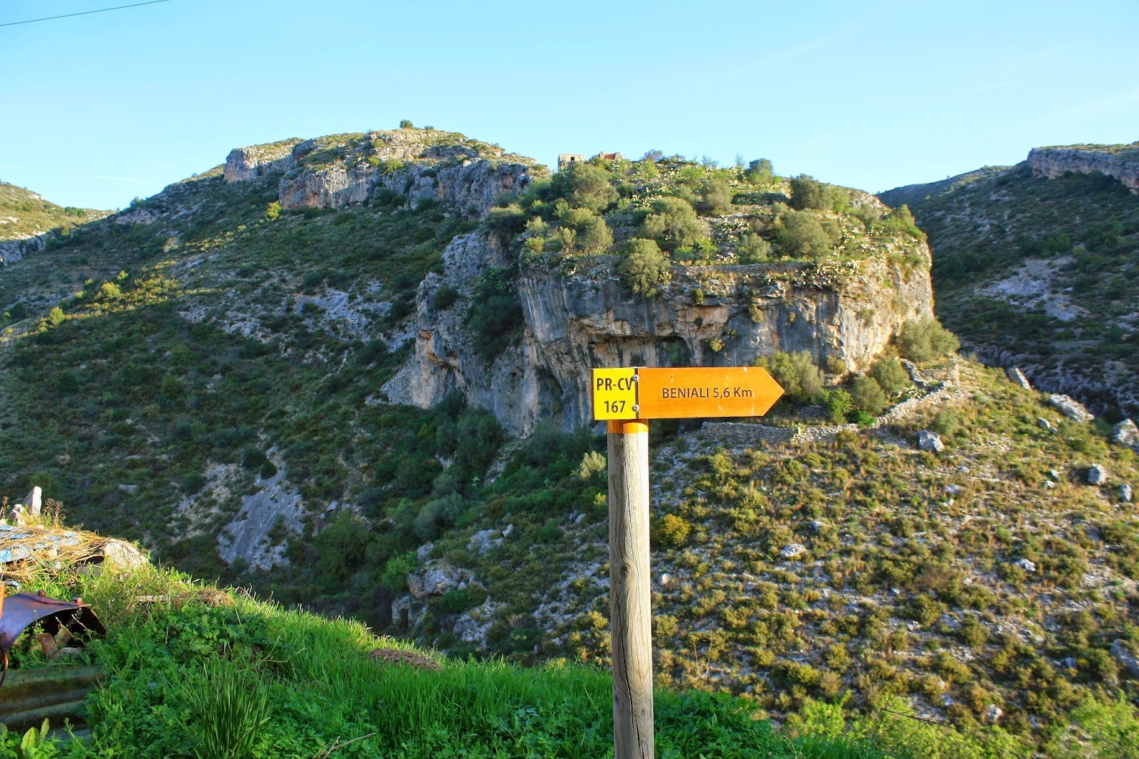
Crossroads along the trial
Source
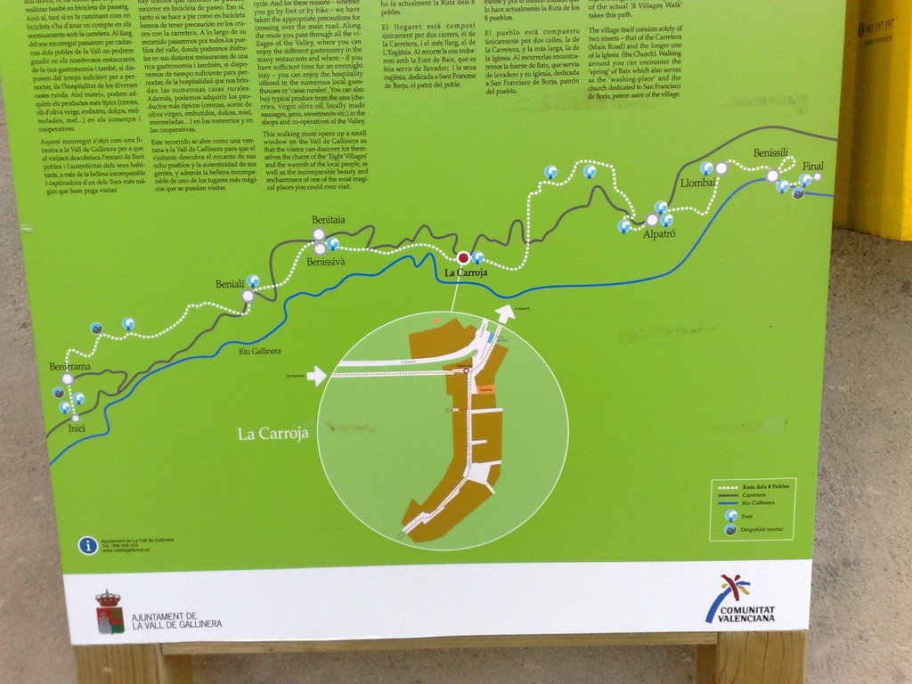
The route of the 8 towns
The route of the 8 towns, will very likely be found under the Valencian name, which is 'la ruta dels 8 pobles'. The route starts at the 'Mata de Benirrama fountain, and finishes at the 'Mata de Benisili' fountain. It is not a circular route, so I recommend leaving a car in Benisili and another in Benirrama. Amongst these 8 towns, you will find a great number of fountains.
The route difficulty is low, the first hurdles are certain parts of the route which can get overgrown with vegetation, and due to the tiny size of Vall de Gallinera, it can be months before they are dealt with properly. In the next paragraph I am going to describe in as much detail as possible and with the best personal touches the roads of the route and information on the 8 towns. Below you have an image of the route in the town of Carroja.
Once in Vall de Gallinera, we start at La Mata fountain - for people coming by car leave the car at Benirrama as there is no space for them at the fountain. The starting point is a bit sad as you will find a sign as above which has been burnt, the council has not replaced it so it has stayed this way. Before setting off, at the starting point take a look at the Benirrama sink.
The route is simple so it will not take long to get to Benirrama, before which you will pass through the ruins of Benimarsoch (in normative Valencian it's called Benimarsoc), the town was depopulated by the 1930s and little remains of the fountain that was once there.
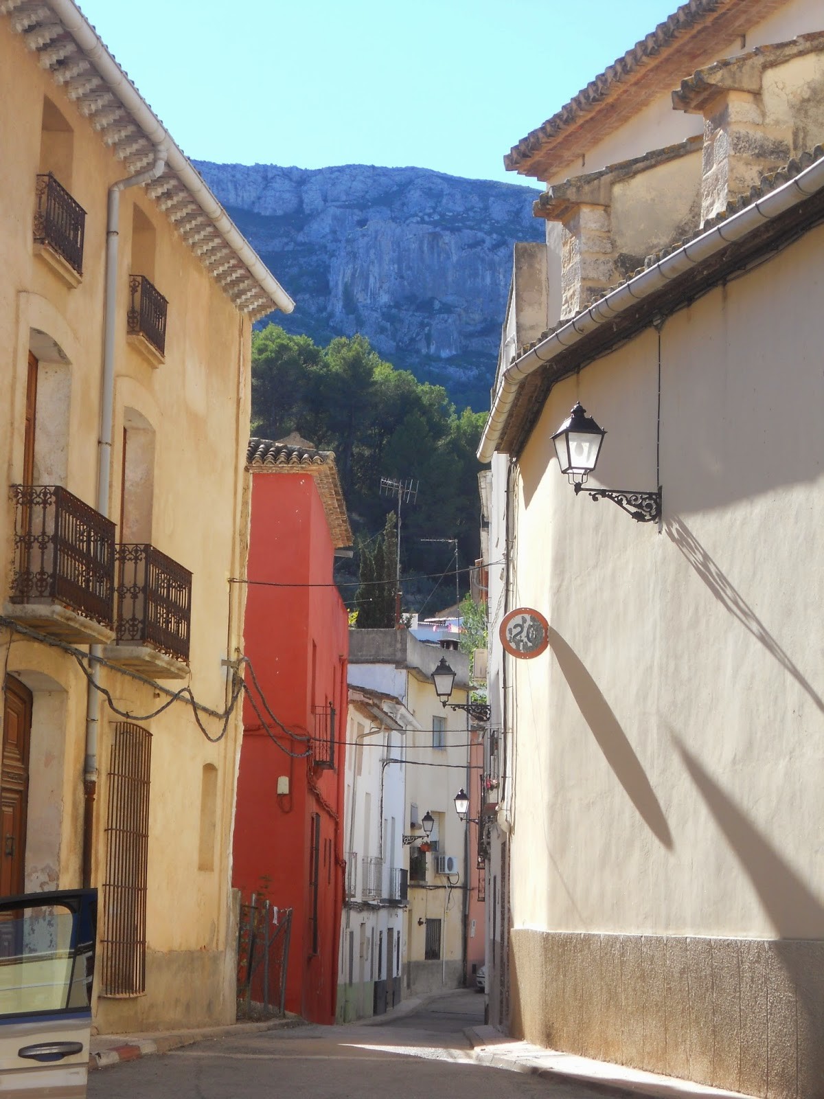
Lastly, we go on to Benirrama, which according to the INE census of 2014, is home to 74 people. Benirrama is without a doubt the most hidden out of all the towns in Vall de Gallinera. Whilst the rest are found on the road, access to Benirrama requires going up a hill, which for cyclists, is not very easy.
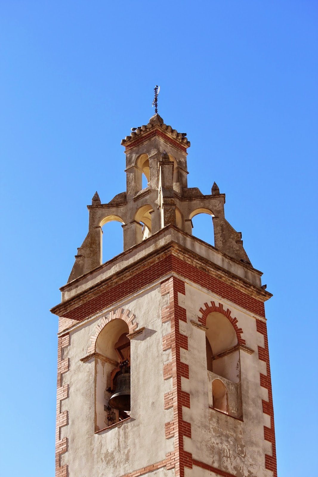
Anyway, it is probably the best place to play 'pelota valenciana'(Valencian handball) due to the town's unique characteristics. It has a bar and a small church. The saint of the church is San Cristóbal and it is remarkable for its 15th century altarpiece. Their celebrations take place in the last week of July, normally in all parties in Vall de Gallinera there is a small musical orchestra or a mobile disco.
Moving on, you take the path towards Benialí, but before this you pass through the remains of the abandoned town Alcudia. This small town disappeared towards the end of the end of the 19th century, as did the inhabitants of Benimarsoch, as they went towards Benirrama or Benialí or directly to the big cities in search for a lifestyle different to that of agriculture. Next, you come to the fountain of Alcudia. Walking slightly further gets you to Benialí.
Benialí
Source
Although not the most populous town, Benialí is without a doubt the center of Vall de Gallinera. According to the 2014 NIE census, it has 146 inhabitants. Benialí is a provider to the council of the Valley (and a place to do all administrative tasks), and has a bank, a tourist information point, a school, and some of the best bars and restaurants (amongst which there is the most famous of the restaurants, called 'Sabors'). In short, whilst in Benirrama there's barely any life during the week, it is the opposite in Benialí.
In the same town you come across another fountain, my recommendation is to take two water bottles, one empty to test the water of the different fountains, little by little. Apart from all the places mentioned above, the small church dedicated to San Roque is highly recommended. Of course, the best festivals in the Valley are held in Benialí during the second week of August.
San Roque church
Source
The fountain in Benialí
Source
It is true that it is not too far from the next village, a small trail brings you up to the village of Benisivá. Benisivá is a much smaller town, not only in terms of the population - 73 people according to the 2014 NIE - but also for the actual size of the village.
The village literally consists of two streets, Olmos Canelsa and Del Raval. One which goes around the main road, and then another, smaller one which is also perfect for playing 'pelota valenciana', and takes you up towards the church dedicated to San Miguel Arcangel.
Aside from the bars, in Benisivá you will find the 'cooperative' of Vall de Gallinera, possibly the best place to buy typical Valley products, so to speak, oranges, olives, almonds... although the star product was without a doubt the cherries.
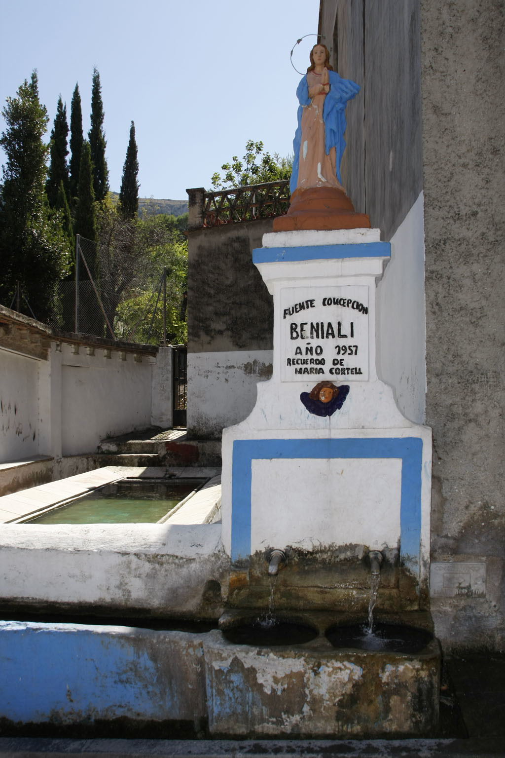
Practically right next to Benisivá you find the town of Benitaya, which according to the INE census in 2014 has just 49 inhabitants. It is a very small, but densely populated village, set in 3, quite originally named streets: la de Arriba, la de Enmedio and la de Abajo. Very close by there is the 'hort' fountain, the calvary and the remains of the convent of San Andrés. Sadly, it is not maintained these days, apart from a small part with cypress trees which formed part of the cloister, but little else. Both Benisivá and Benitaya have their celebrations in the first week of August.
When you leave Benisiva and Benitaya (the villages are very close together), you will be taken to the sink. From here the path unfolds, choosing the path of the 8 villages or going around. Another time I will explain the route back that allows you to take a circular route, but to not make this article any longer and to stick with the main theme which is the corrales de la Carroja, I will continue to explain the path of the route of the 8 villages.
In the summer of 2014 I noticed that the road was a bit bad, so if you too find the CV 700 in poor condition, take the footpath instead. Both roads will lead you to the municipal swimming pool. A large sign will warn you that to go to the pool, you will have to take the road coming off the CV-700. The road was not difficult to walk, but then again it's not a footpath. It can be done by bike or car, but take care as in summer more people use the road in order to get to the Vall de Gallinera swimming pool.
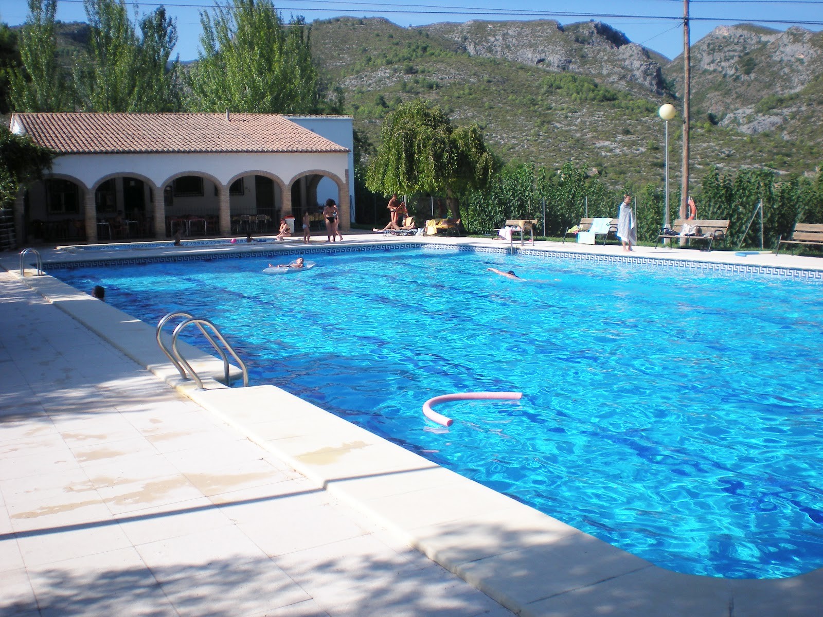
The municipal pool
Source
Once in the municipal pool, you will find yourself feeling refreshed (it is open between the end of June and the start of September). Next to the pool there is a sport center which also serves as a football ground with two goalposts. It's without a doubt in a terrible state, if you go up to the higher ground where you will find a (working) fountain to refill your water bottle.
We go back to the municipal pool and continue along the road, now at a slight incline. Almost at the final part there is a small footpath which takes us to Carroja. Equally, there is the road from Benisivá, which in Summer 2014 was in a very poor state. If you too find it in poor condition, continue to follow it until you reach the top of Carroja.
I can't speak of Carroja in an impartial way, as it's the village that I go to for my summer holidays every year. Home to 22 people - according to the 2014 INE - although the majority (but not all) make a living by constantly going between Carroja and Alcoy, Gandía, Valencia...
Carroja
Source
There is a small restaurant called 'Mesón La Cueva', which I have never been to but it's known for being very expensive. It's said that anyone who goes there to eat, never goes back. For if you want to eat something there are places in Benisivá, Benialí or Patró.
The town, aside from the luxury of the swimming pool, has a church dedicated to San Francisco de Borja, the same patron as in Gandía, as a result of being a part of the Duke of Gandía's manor.
Another curious thing is that whilst the rest of the towns have arabic names (Beni, comes from the saying 'son of'), Carroja has a non arabic place-name, said to be of latin or pre-roman origin.
As for the streets; there is 'la de la Carretera' and 'la de la Iglesia'. La de la Iglesia (church) encompasses almost the whole town, including part of the church square as well as the other square (which informally has other names), two dead end alleyways and another taking you to 'the end of the town'.
In general, it comes across to me as quite a pretty town; all of the houses are in good condition and at 'the end of the town' you can find a selection of unique plants. In the biggest square there there is an open air oil press. The celebrations the third week of August have made no money in recent years, and the there was a low turnout of people, essentially this spot is left to Patró.
Something noteworthy is the Abajo fountain, (although in summer watch out for the bees), which is a prominent for it was the old clothes washer for the town. If you follow the road straight on, you will come to another fountain on the route of the 8 towns, which is the fountain of Rosal. Historically, couples came to this place to get away from prying eyes.
The "official road" indicates that from the fountain below, follow the marked path and to a small hill that will take us back to the CV-700. Some years ago it was difficult to go up to here but the last time I saw it, it was fine, if you find it to be poorly maintained go directly to the fountain of Rosal. Once at the fountain of Rosal, you will find yourself at the same level as the CV-700, following the curb will lead us to the next road.
The next road above that of the CV-700, is set on a fairly high hill. Here there's a chance you might get confused. Once reaching the top, you will come to the fountain of San Pedro, otherwise known as 'd'En Pere', which to me doesn't seem like a very remarkable fountain, in summer it doesn't even have water flowing. Then, you'll return to the end of the road (where there was the fountain from before), and continue on along the path which goes back down to the CV-700.
You will be at the Vieja fountain, or 'font Vella' in Valencian. The fountain's water is quite clean for the mountains but you will have to bend down quite a bit, in this instance the bottle will be quite useful.
A small path will lead up to Patró. Patró - or Alpatró - is the largest town of the Valle, with 186 inhabitants. It has a small museum dedicated to oil and all of its tools, as well as a restored olive press, the museum is named 'Museu Etnològic de la Unió Cultural: l'almàssera dels Moltó' (with translates to 'the Ethnological Museum Cultural Union: the mill of Molto'). In order to visit you have to call them; searching the name of the Valencian name of the museum online will give you the phone number.
Aside from the museum, there is the Church of Our Lady of the Assumption, the altarpiece there is noteworthy. In front of the church there is a fountain ideal for taking a rest. The town has some small shops and three bars. There's also a small school although it is soon to be gone. The celebrations here take place on the 15th, 16th and 17th of August although in recent years they have taken place when it came to Carroja,.
You will leave the town for the sink; the water from the sinks are drinkable but I recommend (with there being so many) to take advantage of the fountains. We will go downwards, to the road which is no longer the CV-700 since Patró heads towards Planes; this small road links Patró with Llombay and Benisili and is named the CV-714.
This final part has no proper footpaths although there are some small sections to go on when you reach curves in the road, but generally you have to walk on a paved road for this part. Once we go down to a bridge, we will climb a small but steep hill. If you go by bicycle, after the ascent of Benirrama, this part is without doubt the steepest section that you will find on the route of the 8 towns.
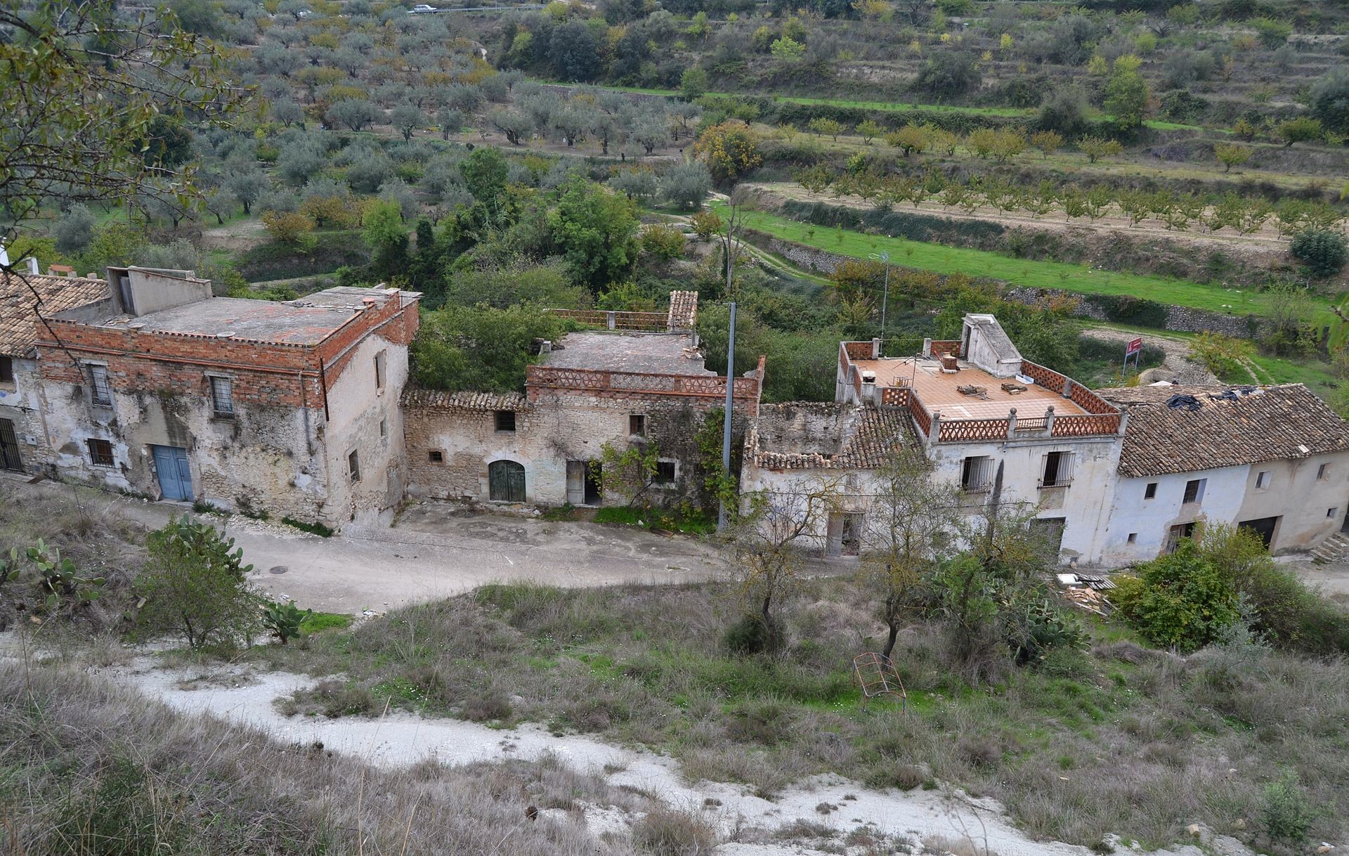
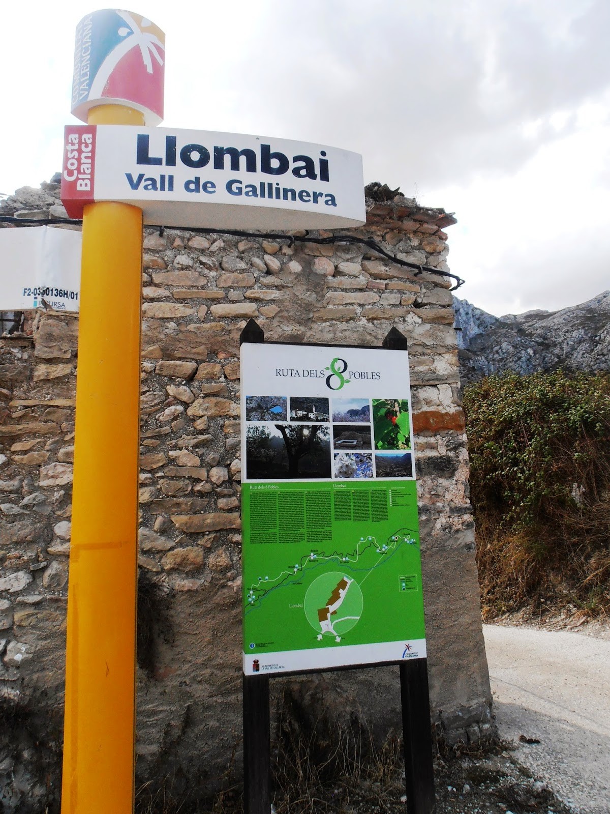
Lastly, you will head towards Llombay, otherwise known as Llombai. There is another town in the province of Valencia which is unremarkable apart from the name.
The village was abandoned in the 40's and 50's, some fled to the larger village of Patróm whilst others went to the city. Its last inhabitant was a foreigner named Stefan Gregor, Don Esteban to the rest of the valley. He occupied one of the abandoned houses and was known as the "Alemà de la Vall" (the German of the Valley).
Llombai was abandoned in the 40s and 50s
Source
Llombai today
Source
One day some men wanted to kidnap him so he made a house near the castle of Benisili, his "nest of eagles. " He died in 1977 so that in Llombay the mystery of whether he died naturally or was killed lives on. His origin was that of former Yugoslavia although a German magazine indicated that he had worked in an concentration camp in Austria.
In recent years some TV programs such as Cuarto Milenio have expressed an interest in the last inhabitant of Llombar, this abandoned town is a gem with a story like this.
Aside from this story, the village is not home to a church, instead having a pretty three jet fountain, recently restored with some skill. Its water is possibly the best in all of the Valley. Aside from this, you can find diverse houses, the majority in ruins although in recent years there have been restorations done on some of the houses, therefore, the 2007 census had to be recounted, and in 2014 they recorded just one inhabitant.
It appears that some youths have opened up several of the ruined houses, in the village just mentioned, and filled them with graffiti, which is a huge shame. Although this town has been abandoned (or at the very least practically abandoned), the surrounding countryside is very cultivated. You can also see the ruines of the village's olive press.
1km away you will find the the village of Benisili, which marks the end of the route. Benisili, otherwise known as Benissili, formed part of the Vall de Alcalá up until the 19th century, when it united with the Vall de Gallinera. The reason is due to the proximity that Benisili has with Patró since Alcalá de la Jovada and Beniaya (which are the municipalities that form the Valley of Alcalá) are further away.
According to the INE census of 2014, Benisili is home to 44 people. The church of Benisili is dedicated to Saint Pascual Bailón and has a beautiful fountain. Their festivities take place in the last week of August, marking the end of summer.
Leaving Benisili takes you to the abandoned town of Solana de Benisili. The village has had some remaining contruction left but not mcuh else. And finally we come to the Fountain of Benisili
Whoever decides to hike this route I hope you like it as much as I did. It may seem long at 20 km, but I do not think it seems so, as there are no excessive steep sections and the landscape is unique, full of cherry and almond trees. For sure the best time to go is when the cherry trees are in full bloom, although you can go throughout the year. This route is a perfect way to discover all Vall de Gallinera. In future posts I will talk about out other highly recommended places in this beautiful valley.
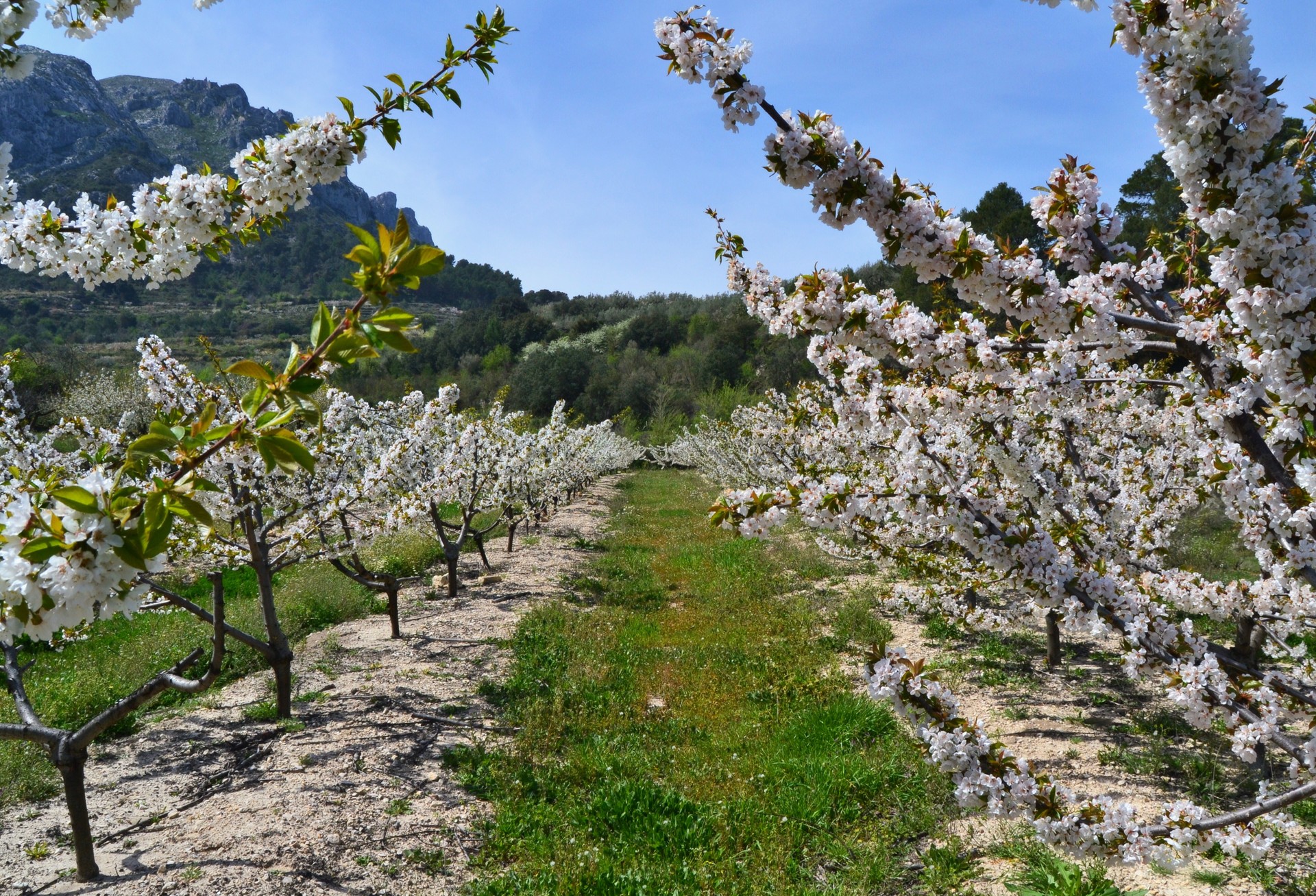
In spring the cherry trees are in bloom
Source
 What to see Vall de Gallinera,
Vall de Gallinera,
Spain
What to see Vall de Gallinera,
Vall de Gallinera,
Spain


