I am sure that each one of us secretly loves hiking. No, I am not talking about those super – long, cross - country hiking trails, but a short, few hours long, relaxing hikes. I can consider myself very lucky, because I am living in Slovenia and this country has some really spectacular hiking trails. Here, you can find trails for both short and long hikes, from easy ones to the very difficult ones, and for all age groups.
Since summer was getting closer and closer to the end, I have decided to take an advantage on probably one of the last warm, sunny days in August. Unlike other summers in the past years, this year the temperatures were not very high and therefore, I was able to hike quite a lot of trails. The one I am about to describe in this entry, was definitely the best one.
There is a nice and fairly new hiking trail very close to where my parents live, called Huljeva pot (Huljo's trail) and since I was visiting them on that week, we have decided to check it out. Actually, all of my family members, me included, have heard quite a lot of (mostly positive) things about this trail, so we have all agreed that it was about time to finally see it for ourselves. And we were not disappointed. In fact, we were more than impressed, and also sorry that we did not go there before. You can read more about our experience on Huljo's trail below.
The name of the trail
Huljeva pot got its name from a man, who has lived in the village close to where Huljeva pot is situated, called Kobarid. He was a person, who tried hard to establish some new hiking trails in the area and maintain the already existing ones. He believed that western Slovenia has a very big potential for hikers. After he died, they have named the trail that he used to frequently walk on, after him. Before that, the trail was not known to wider public. If you ask me, this is a nice way of paying respects to such a great man.
Once a year, a memorial walk of the Huljo's trail is happening, and every year, there is more and more people attending it. I have not attended it yet, but if I will not be travelling when the next memorial walk will take place, I will definitely attend it. After all, socializing with other hikers is a nice way to meet new people and have fun.
Where is the trail situated and where to start walking?
You will find Huljeva pot in the western part of Slovenia, more precisely, near the city of Kobarid. This is where most of the natural wonders of the whole area are also situated, and in case you are planning a holiday in this region, Kobarid is a perfect place to stay. Most of the attractons are even situated within the walking distance.
The trail starts on a parking space on the way to the village Drežnica. If you are there by car, you can park there – the parking fee costs two Euros per hour (Which is a big rip off for the non – guarded parking space, if you ask me), and you can also walk there from Kobarid. The directions are the same for both 'means of transport', and they are the following:
From the main square in Kobarid, start walking towards the Kobarid museum. This is a big white building with signs 'Kobariški muzej' all around it, so you will definitely not miss it. When you reach the building, follow the main road until you reach a junction. You have to keep walking on the right, because if you turn left, you will get to Bovec. (Well, Bovec is also a nice place, but I will leave it for another day.)
After that junction, the road will go slightly downwards. Soon (in about five hundred meters) you will see a scenic bridge with a green river below. This is the Napoleon bridge, and the river below is called Soča. From up there, the river looks really inviting, and you will probably wish to take a swim inside. But do not be fooled – Soča's temperature does not exceed fifteen degrees even during a very warm summer. Well, if you are brave, you can take a quick swim before starting the trail – you will definitely not feel the summer heat after that!
When you cross the bridge, you have to turn left. In about two hundred meters, you will see that parking space on your right. There is always plenty of shadow there throughout the day. The parking is usually not full, not even on weekends, but in case you do not find a parking space, you can leave it in a campground on the opposite side of the road. But be careful, you have to pay the parking fee anyway, and put the ticket behind the windshield, otherwise you risk paying 60 € fee.
To sum up, if you are driving from Kobarid, you will reach that parking space, which is the starting point for the trail, in less than five minutes, and if you are walking, it should not take you more that twenty – five minutes.
At the far end of the parking space, there is a sign that shows you where exactly the trail goes. On there, you can also see, how long each part of the trail approximately lasts.
The exact starting point of Huljeva pot is somehow hidden in the bushes. But it is easy to find it if you know where to look for. So, if you are standing at the sign that shows the trail, you are very close to the start. Just take a few steps to your right side from the sign, and you will see a big rock in front of you with a red arrow, painted on it. If you are in doubt where to turn on the trail, just follow this mark (red arrow). There are a few junctions on the trail, but this is one of the best marked trails I have ever been to, and the marks leave no doubt on where exactly you have to go.
Duration and difficulty level
This hiking trail consists of several parts, and there are two places where you can decide whether you would like to take the easier hike or the more difficult alternative. Please keep in mind that the harder part of the trail is really only for those people in the top body condition (which I am not, so we took the easier one), because the way is very steep at some places, and you also have to climb a bit at three points. But if you choose the more difficult alternative, you will get to see nicer views, although those at the easy alternative are not bat either.
So, if you decide to walk the easy trail, the whole walk will take you about two and a half hours – this is how long we walked, and we really walked quite slow, and we have also stopped a few times during the hike to admire the breathtaking views.
The harder trail is said to last about three hours and a half, because it makes a big detour on the other side of the Ozben hill.
As you have probably already guessed from what I have written above, this trail has two difficulty levels, and you can freely choose which one you will take, regarding your abilities and body condition.
The trail and sights on the way
As I have mentioned above, the trail starts on a parking space on the way to Drežnica, and the starting point is a bit difficult to find if you do not know where to look for it. But I have written the directions, so you should not have any problems at all with finding the right place.
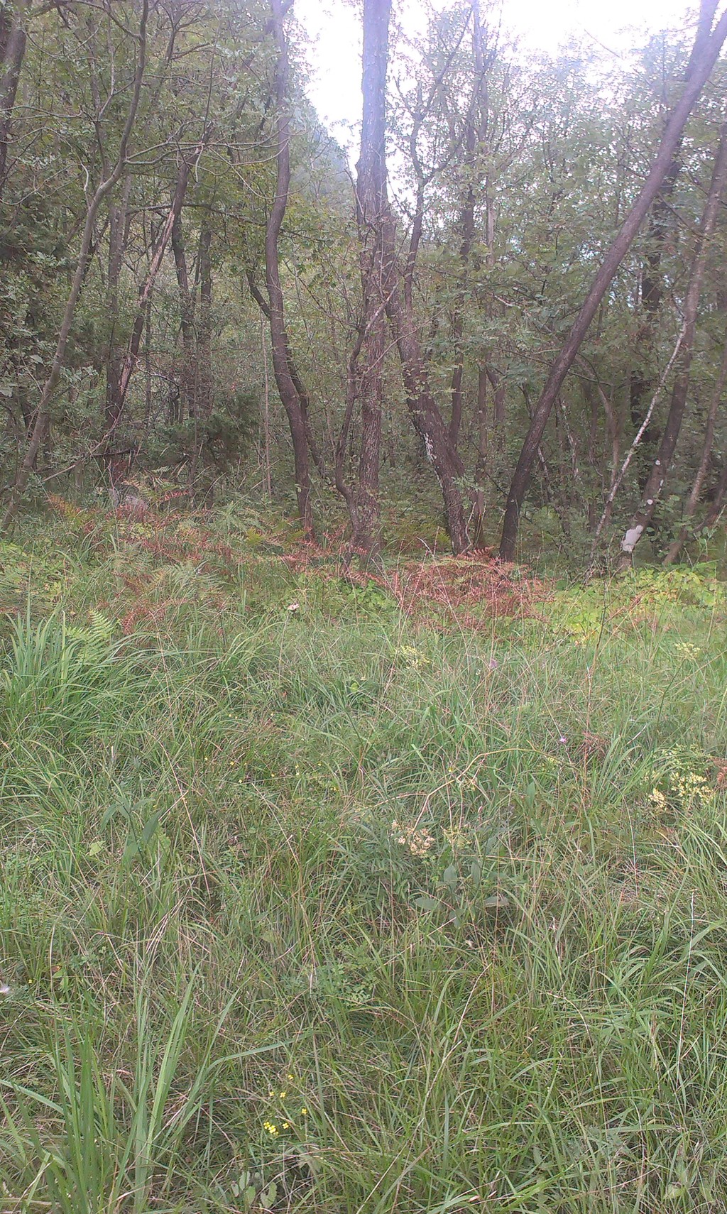
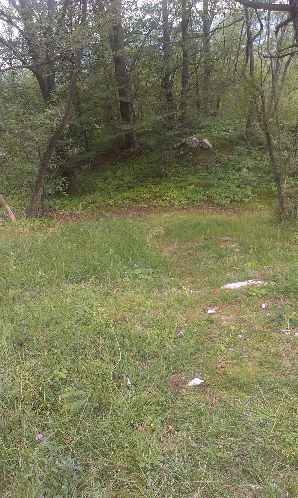
After you have found the starting point, you can start walking. First thing you will see, is a very steep hill in front of you, that you have to hike. It indeed is a bit difficult, but luckily, this is the hardest part of the trail. And, in my opinion, it is better to get rid of the difficult part at the very beginning, and not at the end, when you are already very tired.
When walking upwards, do yourself a favour and look back from time to time to see what you have already hiked, and how steep the hill is. I am sure that it will make you proud. From up there, it looks much more steep and you will definitely be proud of yourself because you survived such an exhausting uphill hike! During that difficult part, be careful because the terrain can be very slippery at some points and some rocks that you might want to step on, are not stable. But just try to keep your eyes on the trail and you should be fine (so do not use your smartphone while hiking!).
After that quite exhausting part, the path suddenly becomes much nicer. At this point, you will be walking through a lush green forest, and the only soundtrack will be the birds singing. Believe me, it is very relaxing, especially if you are coming from a bigger city. When walking at this part of the trail, only be careful of the tree roots, because they are often hidden under the leaves, and it is easy to fall if you are not paying attention on where you are going.
Soon, you will reach the first viewpoint, which is situated almost right above the parking space, where this trail starts. Its altitude is not very high, but still high enough for a nice view, which gives you a glimpse of what you will see when continuing the trail. If you are walking this trail in summer, it is sometimes pretty difficult to see from this viewpoint, because the trees are covered in leaves, but if you walk around a bit, you will eventually reach a spot where the view is better.
There is also a small bench at the very edge of this viewpoint, and this is a perfect place to hydrate yourself while admiring the view, and maybe even taking a few pictures. In the distance, you can see a green meadow and a few wooden huts – this is a camping ground and if you do not feel like camping, you can spend the night in one of those huts. If you look further, you will even see the river Soča in the distance.
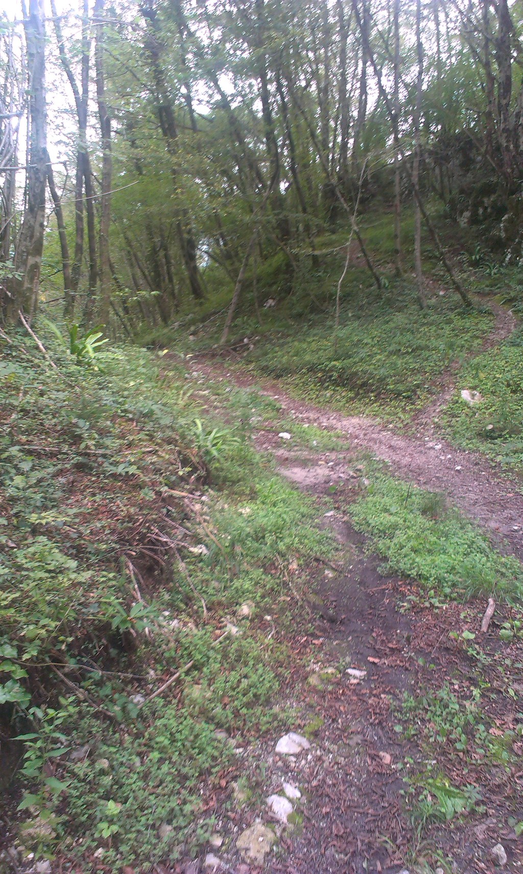
After admiring the view and also resting, you are ready to continue the hike. The path now still goes through the forest, but the terrain is a bit more rough here – a lot of rocks on the way. Shortly after you are over the difficult terrain, the path will go downwards. It is not a very difficult part, but you should still be careful where you step so you will not slip.
When you reach the bottom, you will see an asphalt road at the end of the forest. This is the road that goes to Drežnica, and you have to cross it to continue the Huljo's trail. Be careful when crossing, because there is a curve just in front of the crossing point and you might not see the car, approaching you, so better check twice than just run across.
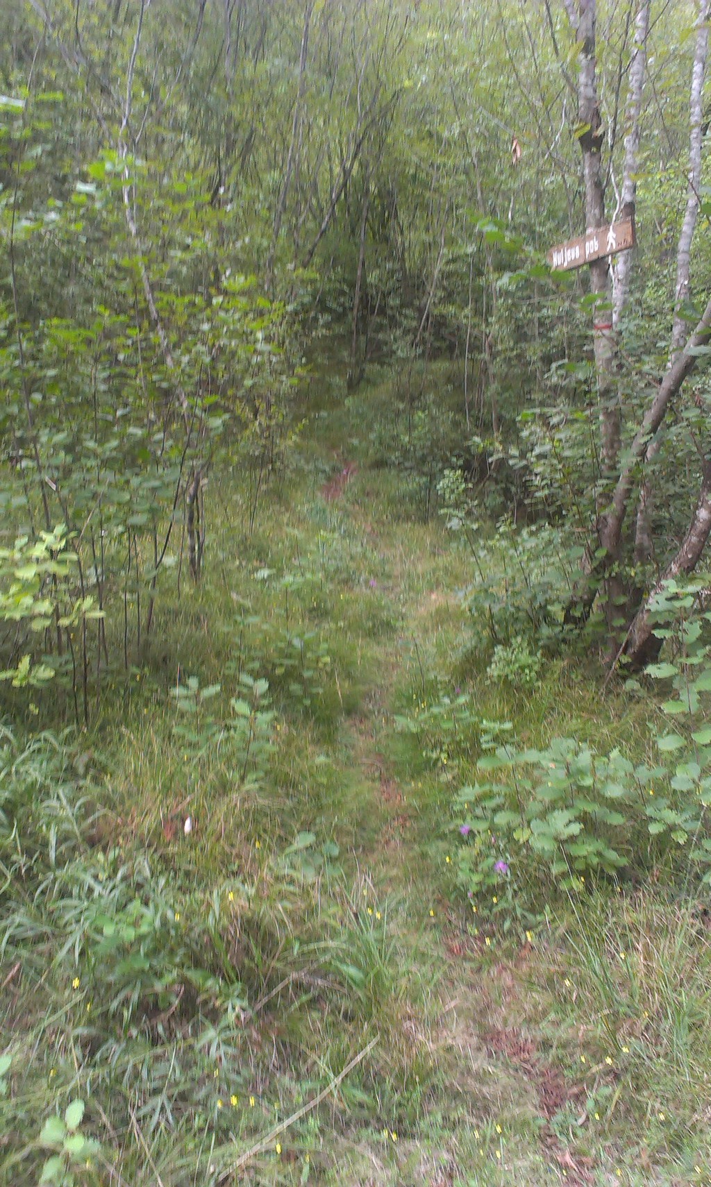
When you have successfully crossed the road, take a look on your left side – about ten meters away, you will noticea small, wooden sign, saying 'Huljeva pot':
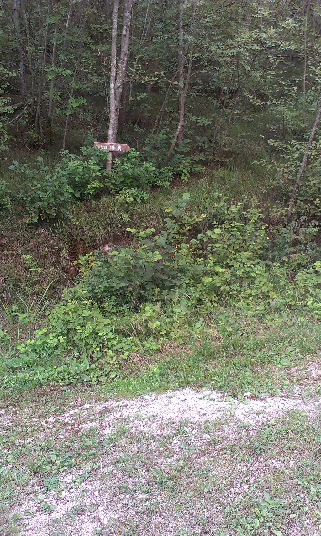
It is pointing seemingly to nowhere, but when you look closer, you will see the path, and this is exactly where you have to go to continue the trail. This part goes through a small pine forest, and it smells really nice in there.
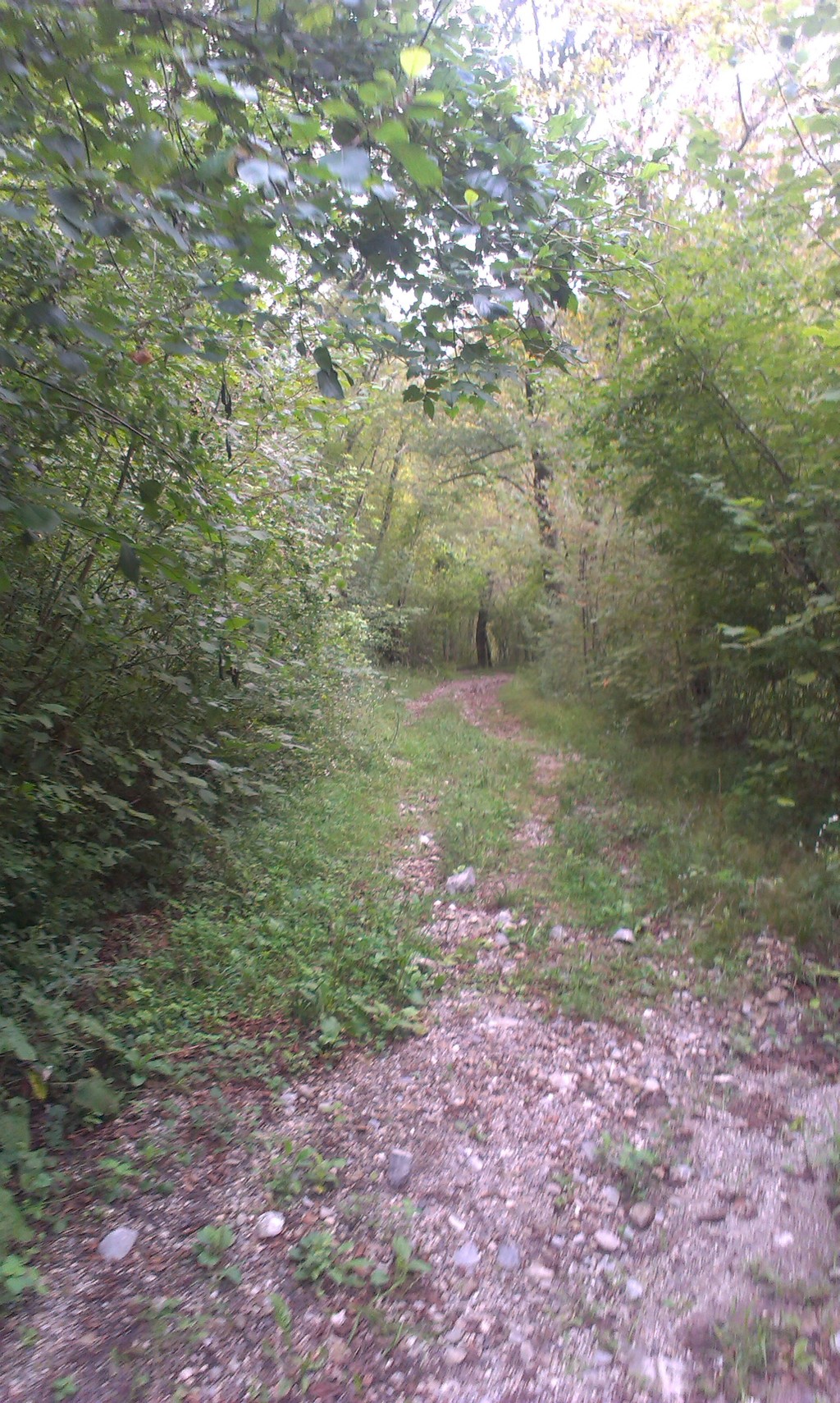
After a while ( I would say about fifteen minutes), the path suddenly becomes wider and it is much easier to walk there. But please be careful, this part is often used by mountain bikers, and they are going too fast, not even being careful about other people on the road. So I would say that it is best to keep walking at the right side of the path.
At this part, you will also see a lot of different wild berries. You can eat as much of them as you want. Actually, I was very surprised that tourists did not pick and eat all of them. Believe me, they are very sweet, and therefore tasty.
Soon, you will reach one of the junctions I was talking about before. If you continue walking straight, this would mean the harder trail. But if you turn left, the rest of the hike will be much easier. Also, if you ask me, the easier hike is also much more scenic and it gives you better views that you do not get to see when taking the harder alternative.
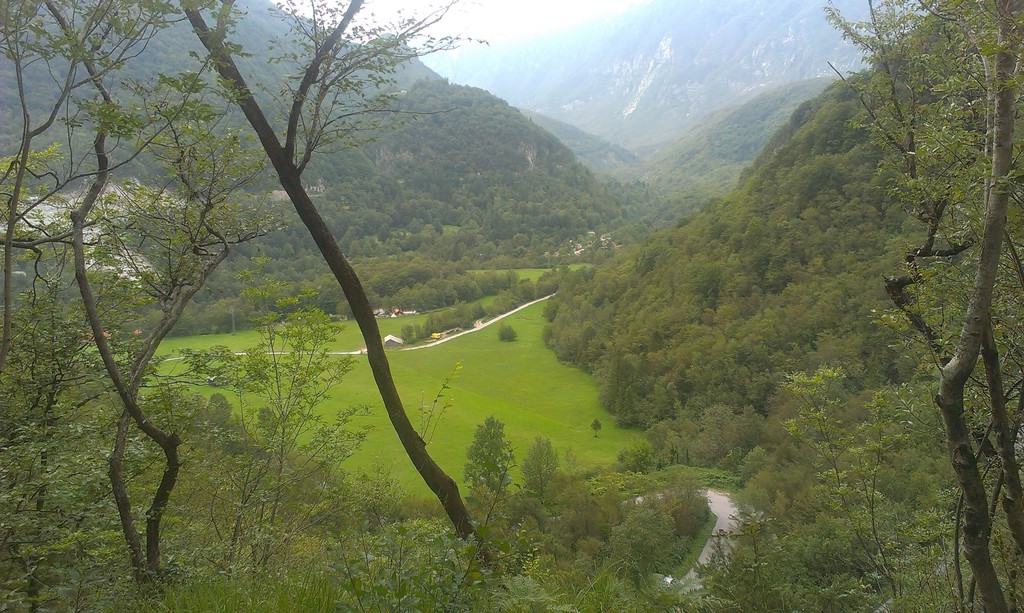
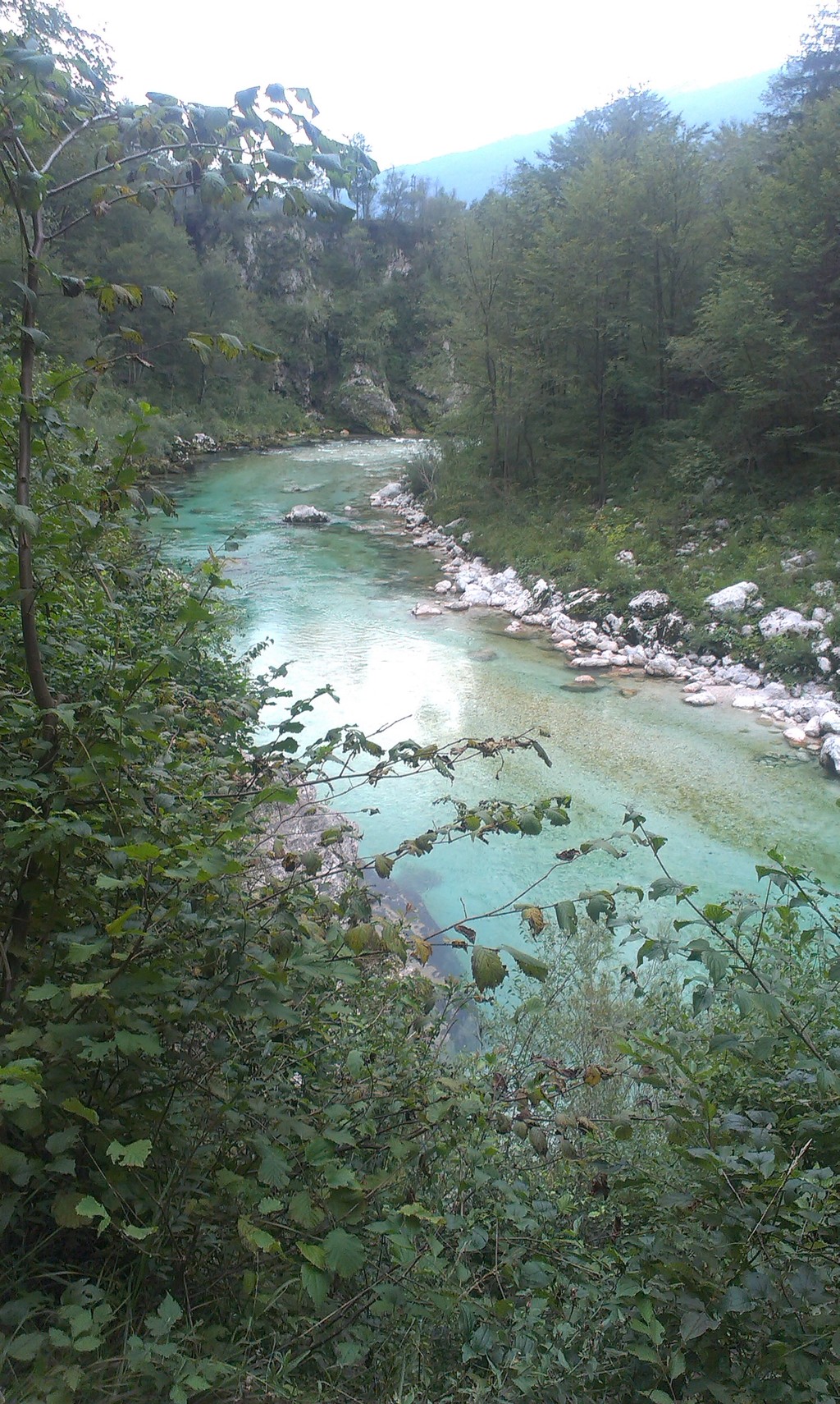
At this junction, there is another beautiful viewpoint, and there is a nice bench, too! From this viewpoint, you get to see the same place as from the previous one, but from a different perspective, and from a higher point of view than before. Also, from here, you have a direct view of the beautiful river Soča below the hill.

From now on, there comes the easiest part of the hike so far. The path will now mostly go downwards, and the way is not very steep. After a few hundred meters, you will be hearing a whooshing sound. This is the river Soča, now situated just below you. While you continue walking, the path will be going closer and closer to to this beautiful river.
Soon, you will reach the third viewpoint of this trail. This place is, besides the viewpoint, also an outdoor museum at the same time. So what you can see from this viewpoint? River Soča and the valley it has made through centuries. It is really worth to stop here for more than just a couple of minutes to see and listen to the river. There is also a bench and a picnic table there, so if you have no eaten yet, this might be the perfect place to do so.
And what is this outdoor museum about? First of all, let me tell you some good news – you do not have to pay anything to see it. This museum mostly consists of remainings from the first world war, and it also has some reconstructed buildings where the soldiers used to either hide or live.
When you decide to continue the trail, the path will bring you to the bank of the Soča river. From such proximity, the blue – green colour of the river is even more beautiful. Definitely better than on pictures. By the way, when you are looking at the pictures of the Soča river, its breathtaking colour looks unreal, and it might even seem photoshopped, but it is not!
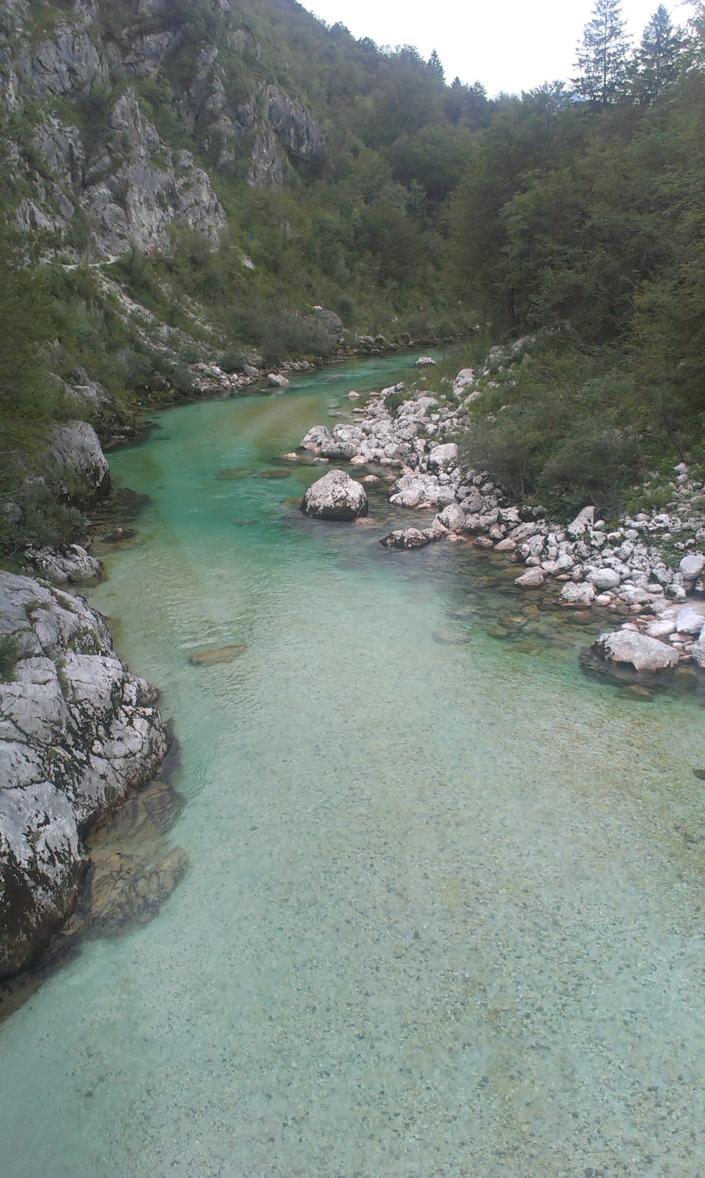
You will probably be surprised when you will see almost no fish in the Soča river. There is a fish that lives inside, and it is endemic in this river, called the Soča Trout, but the municipality has decided that it has overpopulated and started 'controlling' their number. I believe that they are close to extinction now, which is really sad. A few years ago, you could see plenty of them everywhere in this river.
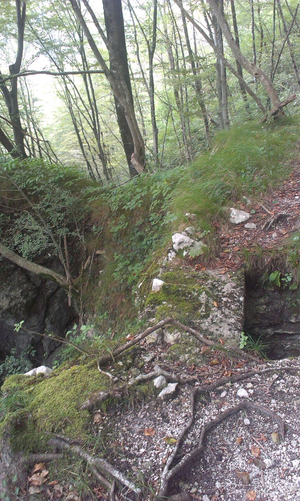
Now, the remaining of the trail will lead you very close to the river, but sadly, you can not go all the way down to the water, because rocks make it totally inaccessible. After about half a kilometer, you will cross a small bridge, just next to a small waterfall. Take a look on your left side, you will be surprised, how deep the gorge is.

Soon, you will arrive into the canyon. You will see a couple of bridges and ladders, which might seem a little bit difficult to climb, but when you know what waits at the end, you immediately realize that it is well worth the effort to get there.

Behind the walls of the canyon, there is a majestic waterfall, seemingly falling from heaven, and the water below it has an amazing greenish colour. This part of the canyon is almost completely closed, there is only a tiny hole at the 'roof' of the cliff, where the waterfall comes from.
I have took some pictures so you can admire this amazing nature wonder:
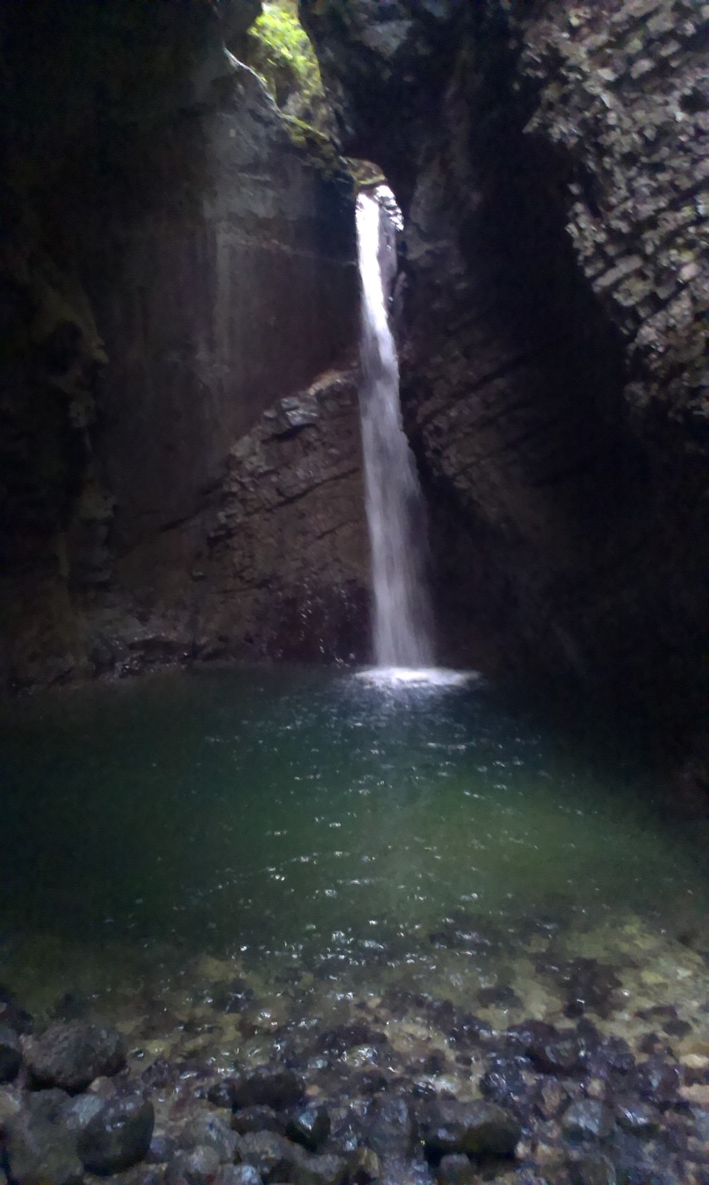
A few years ago, a famous cliff diver (although I cannot remember his name right now, but I know he is from Venezuela and he also jumped from Napoleonov most) has jumped from the top of that waterfall. The water is deep enough to do so, but from what I know, he was the only one who jumped, because the jump is technically very difficult and you must be well prepared if you would like to jump from there.
When you think it is time to go back, you have to follow the same road until the outdoor museum. Here, instead of turning left, just keep walking straight. The path here still goes just above the Soča river. After about fifteen minutes of walking, you will arrive to the main road, just in front of Napoleonov most (the Napoleon's bridge). All you have to do now, is cross the bridge and then turn left until you reach the parking lot where you have parked your car.
What is the best time of the year to walk this trail?
I wish I could say that the Huljo's trail is perfect to walk all year round, but sadly, that is not the truth. The most beautiful time to walk there is definitely from late spring to autumn. After that, the ground starts to freeze, and yes, it gets slippery. Also, the western region of Slovenia receives a fairly big amount of snow each winter, so winter is definitely not the time of the year that you would wish to walk on this trail.
Well, if there is no snow and the conditions are good, it might even be nice to walk the Huljo's trail. After all, it will not be hot at all. Honestly, when I did this trail in summer, I thought that it is just a little too hot to be comfortable.
Warnings and advices
Besides advising you to be careful when hiking, I also have some other suggestions for you, that will hopefully make your experience of hiking this trail as perfect as possible:
- First of all, the trail is very well marked. Just pay attention to the red arrows that will point you in the right direction. At some points, there is also a dog's paw instead of an arrow, but it means the same – you are walking the right way. Those signs are there for a reason – the are warning you not to wander too far away from the path. Why? Because, sadly, some hunters in this area are still using bear traps and it is said that there are a few of them set in this area. But as long as you stick to the marked path, you will be totally fine.
- In the paragraph right above this one, I have mentioned animal traps. This can only mean one thing – there are also animals in this forest (obviously). You might encounder a deer or two, but do not get scared – they are definitely more scared of you than you are of them. There has not been reported a bear sighting around here for the last few years, so you really have nothing to worry about. There were also a lot of squirrels there when I was hiking this trail, and they are not afraid of humans at all! If you have a sandwich with you, you can feed them if you want.
- Those nice viewpoints that I have previously described, might seem innocent. But when you walk closer to the edge, you will realize that they are actually higher than you thought. You will most likely get dizzy when looking down, so it is important that you do not stand too close to the edge.
- During both world wars, this region was actually one of the main battlefields. While it means you can spot some historical buildings, you might also find some objects from the war, like unexploded bombs. It is rare, but it can happen that you will see one. Some people think that they are a nice souvenir, but I really do not think so. If you see one, you better stay away from it.
- This is not much of a warning, but more like an advice. When hiking Huljeva pot, I have met a lot of other hikers, and most of them had headphones in their ears. Why would you listen to music when hiking such a beautiful trail, when you can listen to the spectacular sounds of nature instead?
A few words for the end…
I think that if you are spending your holiday in the western region of Slovenia, there is almost no better way of spending a sunny summer day than hiking the Huljeva pot. Actually, even if you are anywhere else in Slovenia, it is worth to go here on a day trip. You will not regret it, because nature in Slovenia is breathtaking.
 What to do Nova Gorica,
Nova Gorica,
Slovenia
What to do Nova Gorica,
Nova Gorica,
Slovenia