Hiking in the Murcia region
Translated by  Olivia Leicester
— 6 years ago
Olivia Leicester
— 6 years ago
Original text by
Laurie Lambert
0 0
Tags: Erasmus experiences Murcia,
Murcia,
Spain
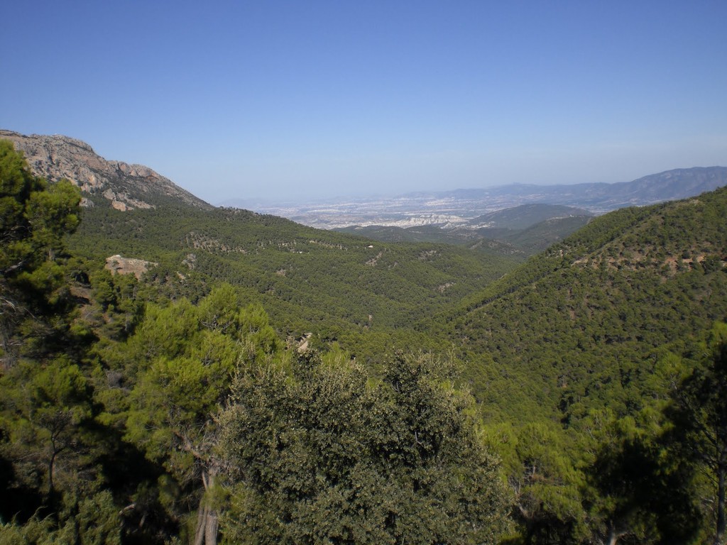
I wanted to write about this experience because I realised that sometimes I have talked about some of my mountain trails, but never in an actual article. Here, you will have a summary of all the possible routes you can take nearby to Murcia. The first question that you should ask yourself if you want to go hiking is: do you want to take a two or three hour journey, or do actual hiking where you spend a day or more walking.
2 hour walk:
For the route, I recommend one lasting an hour or more (depending on if you stop on route to see museums that there are their, on foot from the mountain, or if you have something to drink in the panoramic bars that you'll come across on the journey). This walk specifically is the one that goes from Fuensanta to the town of Algezares, where there is the San Antonio el Pobre museum. To go to one of these starting points, you can:
a) take the bus from Murcia to Algezares. The bus is from the company latbus, and the numbers of the buses are 6, 50 and 59.
b) get the bus from Murcia to the town of Alberca (below Fuensanta). You can take line number 6 from latbus as well. The best thing to do is look at the latbus website. There are the times, the numbers of the lines and all that stuff. There are buses on national holidays as well. So, if you are bored on a Sunday, you could go for a walk. Going back is the same, but you can get the bus in a different town. You don't have to do a loop journey up there.
If you get off at Algezares (at the terminal, then you can go towards the right behind the bus), you will see a tourist office where they give out maps (although they are not extremely detailed). You have to walk a bit from the bus stop to the foot of the mountain.
Then, the journey starts with a small walk, after the tourist office and to the left. It is a dirt road. You follow it and normally the things that you can see/ visit during the route are indicated on the maps. During the walk, you can see the museum of San Antonio el Pobre, the hermit. You can see a part of the cave where the hermit lived. The museum is small but fun. And it's an opportunity to take a break during the journey. The visit lasts more or less 20 minutes, it is quite short. There are signs up about the city and region of Murcia and a voice-over that tells the story of the hermit, and tries to convert you to Catholicism! Behind the museum, you can go up the mountain again by a staircase that is on the rock. To the left, there is a waterfall which is pretty. After you can follow the trail to the left and keep walking to the side of the motorway. This brings you to the second stage: the Centro de Visitantes de la Luz.
It is a modern building divided by floors. On entering the ground floor, there is a museum about daily life in Murcia in the past, and old Spanish customs in general. On the first floor, there is a bar/restaurant. It is cheap, and I think that you can eat well there as it is always is full of people. There are two terraces. One goes behind the building and the other goes to the side, it is a panoramic view from which you can see the city of Murcia. It is very pretty. I recommend going there, even if it is only to have a drink and not to eat. A drink with almonds and this view, it is really nice. Opposite the building, there is an archaeological site with ruins of Roman villas and baths. It is small but it is good to go and take a look at.
Then you can follow the motorway towards Fuensanta. This is indicated on the maps. It is less pretty walking on the motorway, but at least you can see the landscape and the city well. Here is a photo of Fuensanta:
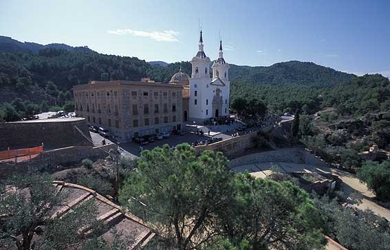
To the side of the church, there is a small tapas bar where I ate. We paid 10 euros each. It was average quality, not bad or good. I'd recommend the croquetas but not the octopus that was from a can.
Then you can go back to the motorway, or on a walk with colourful tiles, to bring you back to the same motorway after. Go down until you reach the town of Alberca, where you can get a bus to Murcia. The ticket costs 1 euro 40. During national holidays, there is a bus that goes directly from Fuensanta (below) to Murcia. Well on Sunday, for example, you can get the bus and you don't have to get off at the town of Alberca.
3-4 hour walk:
This route also starts at the Algezares. It is possible to go for a bit of a longer walk than the one that I have described above. You can also start this walk at Fuensanta and do it the other way round, but it is more complicated because the trails that you have to follow are not very good.
You can take a map at the Algezares Tourist Office. The Tourist Office is at the foot of the mountain. Then you continue on the motorway to the botanical garden and to the barbecue area, where there are a lot of hungry Spaniards. Here, to the right, you will see a staircase that goes up the mountain. You can go up it. Then you follow the black and yellow signs. If you have any doubts, it is better to ask your route. This first road has a specific name but I have forgotten it. You can ask for "the road to go to Relojero". But be careful, you don't have to go to Relojero, but the walk will last 5 or 6 hours and not 3 or 4.
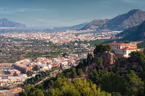
In a bit, there will be a crossing. Instead of keeping straight on, you can take the road which goes to the left. So you will find again the motorway that leads to Fuensanta. On the map, this route is a rectangle. Then you will reach the edge of the mountain. Below you can see some buildings, and below on the right, if you look closely, the Fuensanta Towers (the church). You have to look well because I didn't see the trail the first time. It is a narrow path that leads down towards the Fuensanta church.
5/6 hour walk
If you feel like going even further, instead of turning left as I said before, you can keep going straight. It is also a rectangular route but it is bigger than the 3/4 hour route. Then you go towards the Relojero. It is at the top of the mountain at 800 metres of altitude. There are antennas up there, so you can see it easily. To go up there, you have to follow the path where there is a sign (which is indicated as the Relojero). Then you go back on yourself to go back to the starting path.
If you want to walk a bit further, you can follow the posters to go towards the lunar landscape (it is called that because it was white before, really deserted with a hole. But now it seems normal) the Muralla de King Kong a big brown rock. And be careful, even though you have a map. Because on the map, it looks like it is possible to do a loop and not have to retrace your steps. But we never found this path and in the end, we got lost and we had to go back the same way we came. So it is better to go back to the main road, from the start, and go back the same way.
Then follow the sign for "Las Navetas" and go towards Fuensanta, at the edge of the mountain. You will go past two viewpoints before. But be careful, because when you reach the end of the mountain, you have to go down a path. You'll see the buildings below the mountain. Don't follow the main road to the right, but you will reach Cresta del Gallo. This is what I did. It is a different option but longer.
If you go towards Cresta del Gallo, you can go down here through the town Las Gares or San Jose de la Vega. But be careful, because if you follow the road it is very long. We had to hitchhike. It is better to go down the paths that you'll see beforehand.
Starting at Cresta del Gallo.
One day, I got the bus-stop wrong and arrived at the town Los Gares. There, you can see the mountain behind the houses. So, I wondered if it was worth taking a different bus to go back to Algezares to follow the route that I knew, but in the end, I told myself "all roads lead to... the mountain! " :D. So we went up to the mountain via a different path.
The problem is that I got a bus where the stop wasn't the Algezares' terminal, but a normal stop.
So, we went up behind a cemetery of Los Gares. Behind there, there was a road that goes towards the mountain and then becomes a path later. At one point, we thought about going back on ourselves because the road seemed wrong, but we kept going and we reached the road that goes towards La Cresta del Gallo. What happens is it goes up a lot, for 40 minutes with breaks. It is possible to not follow the path for hours and hours. It is a lot shorter using the path.
But of course, if you have a car you can go straight to the top. The problem with a car is that you have to do a loop or go back on your steps. It's less cool. Then, you will come across a cross-road after following the road. One road leads upwards towards Cresta Del Gallo and the other goes towards the right (to go back to Fuensanta).
In my opinion, the best thing to do is to go to Cresta del Gallo, following the path Las Navetas and going up to Fuensanta. There, there is a path which leads back down to the church.
La sierra de Espuña:
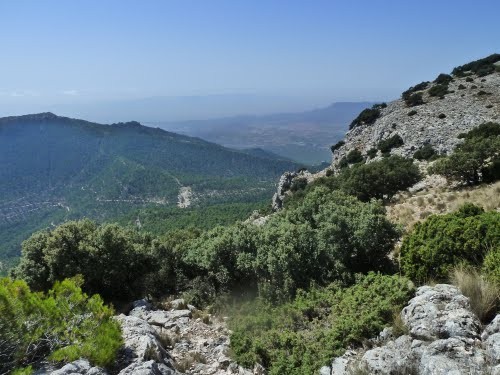
If you want to walk further, with even more impressive views of mountains, I recommend that you go to the Sierra de Espuna. You can get there from many cities. Personally, I went from Alhama de Murcia. I used the bus company Alsa. The bus journey takes 30 minutes, and even less by car. The problem is that in Alhama we couldn't find anywhere to buy a map. So you need to have GPS on your phone or something like that before going there. Otherwise, you will get lost. Take care with your phone, because there is not always service, and it can take time to update itself in the mountains.
The Alhama de Murcia is 4 kilometres away from the start of the mountain. So for us, as we did not go there by car, we had already walked for an hour before getting to the path that we wanted to take. Of course, it is a lot easier to get there by car. You can start the walk further on and enjoy other landscapes which are higher up. Although the ones that I saw, I really liked.
There are lots of trails and they are very badly indicated. So do not go without a map and all of that stuff, because lots of people get lost each year. Take water, food, and check the weather forecast. If it is really hot, it is better to not go.
Alhama is a really pretty village. If you have the opportunity to stay there for a day or two, it is worth it. To the side of the road which you drive on towards Sierra, there are some cool bars which you can stop at. When you are on the way back and you have 20 km still ahead of you, it's great to stop here and relax.
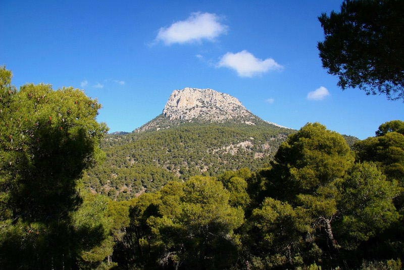
Photo gallery
Content available in other languages
- Español: Hacer senderismo en la región de Murcia
- Français: Randonnées dans la région de Murcia
Share your Erasmus Experience in Murcia!
If you know Murcia as native, traveler or as exchange student... share your opinion on Murcia! Rate different characteristics and share your experience.
Add experience →


Comments (0 comments)