Heading South - the Nelson Region
Published by  Nadine Schlehofer
— 8 years ago
Nadine Schlehofer
— 8 years ago
Blog: Disovering Kiwi Land on the other side ot the world: work and travel in New ZelandTags: Erasmus blog New Zealand,
New Zealand,
New Zealand
As I already mentioned in the last post, we came almost late for our ferry as we had been stuck in a traffic jam of a herd of cows. We already had that several times, but normally they have their own paths and just cross the roads some times. Often, they already have tunnels or bridges for them, which is pretty progressive. But as there were only mountains and the beach, they followed the road for quite a long time. Luckily, I always plan some more time for the journey – you never know what happens, especially not in New Zealand – and we still arrived on time. This time, we could not just come spontaneous, but had to book the journey in advance as we took our car with us. We left the car on the floor for the cars, put the hand break and left a bit unsecure. I was hoping that nothing would happen to the car. During the three and a half hours to the South Island, the weather was mostly calm and my worries about the car decreased. It was very beautiful, because you could always see the changing land. Already after one hour, we arrived at the fjords of the South Island, but between them was the longest part of the journey. With the sun and wind blowing through the fields, the Marlborough Sounds looked just stunning. At around five o’clock, we arrived in the small town of Picton and started our way to Nelson, where we stayed overnight in a backpacker.
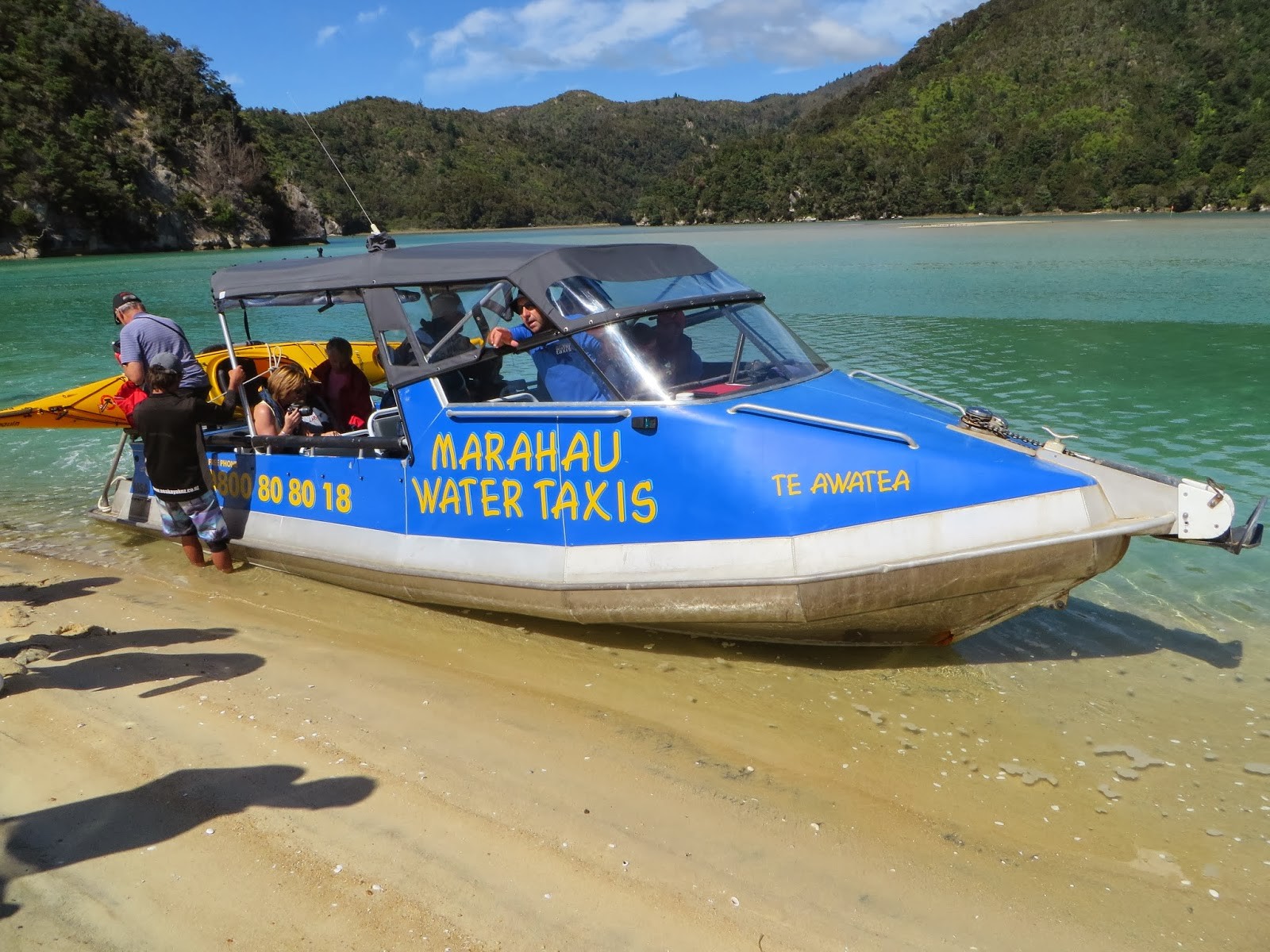
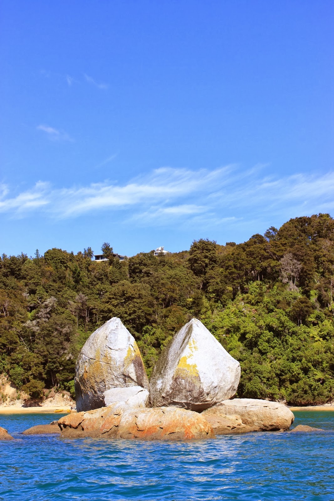
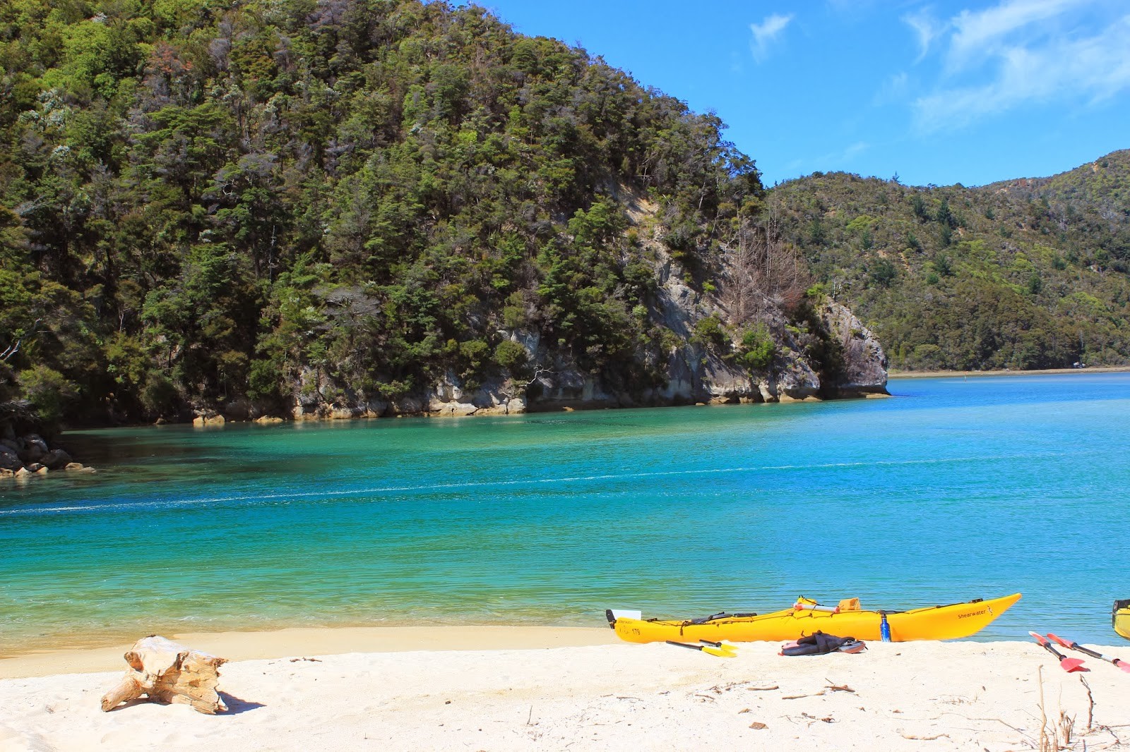
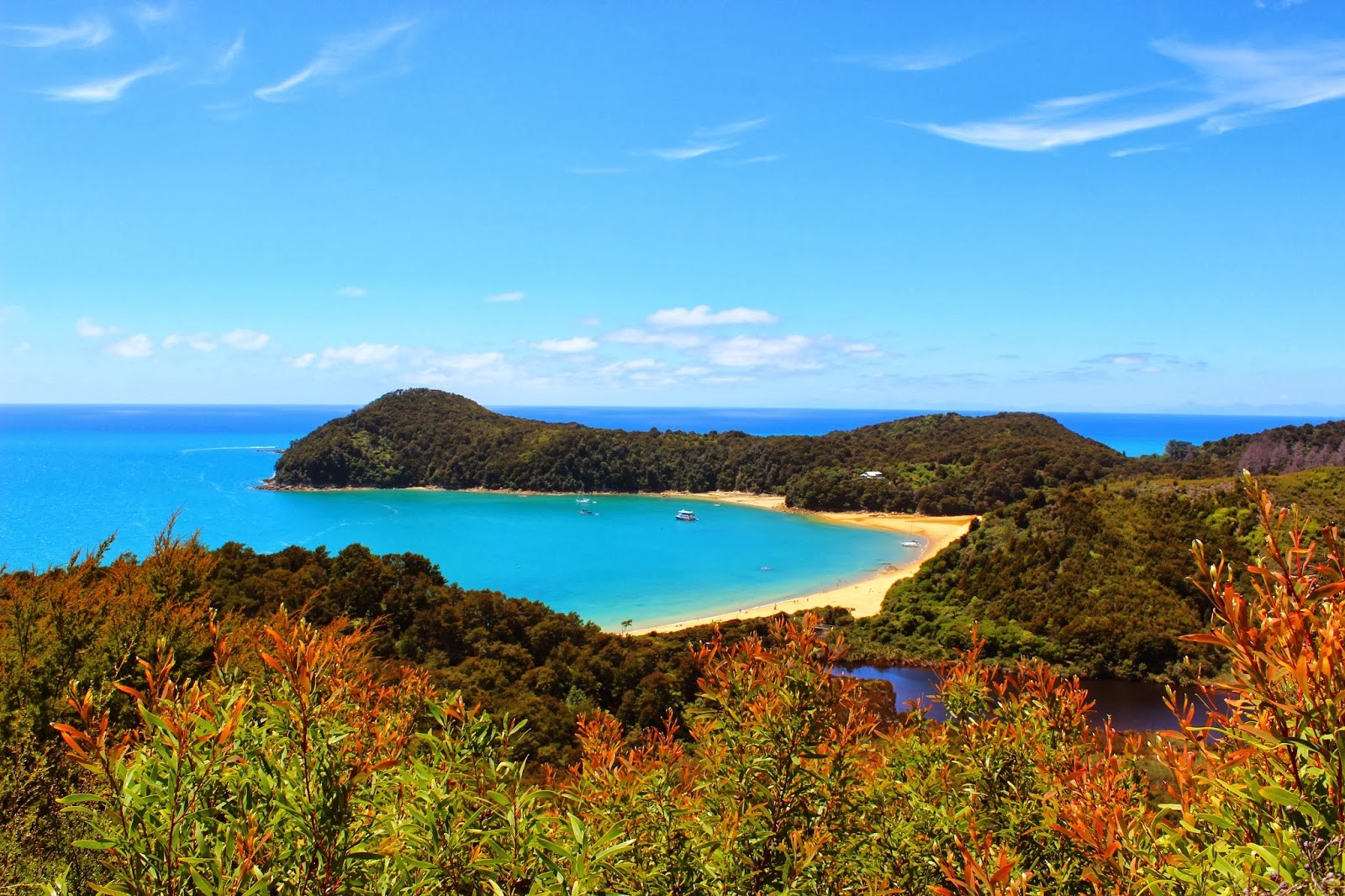
Already the next day, we took a water taxi to Torrent Bay in the Abel Tasman National park. That meant to get up early and drive to Marahau. As the roads lead through the mountains, you should plan some time for that. The water taxi is a small boat that drives along the coast and stops at several beaches. On the way, they do some sightseeing and showed us the Split Apple Rock – a huge rock, which is split in the middle, nobody knows how – some fur seals and we even saw a blue penguin! In Torrent Bay, we got off the Taxi and started our way back with the best weather. It is part of one of the 7 great walks in New Zealand (there is even an app for them), which always take from one to several days, but you can also only do parts of it as we did. Also, the Tongariro Crossing is one of them and can with some detours take up to three days. For that, you always have huts on the way for staying overnight. But you have to book them beforehand and depending on which one, that can be a lot beforehand. That was why we only went for one day as so spontaneous we couldn’t find a place to stay. The Milford track, is almost always booked out over a year before. It took us seven and a half hours to do the 17 kilometres, with several stops for swimming, taking pictures or just enjoying the view. The beaches look very nice and inviting, almost like in the Caribbean, but don’t get fooled! The water is as cold as in the rest of New Zealand. And in addition to that, the wind is always blowing. On the way, we saw different, nice landscapes. Sometimes, we hiked through the forest or along the coast and sometimes, several metres higher in the hills, overlooking the region. During midday, it got really exhausting as the temperatures were rising and rising and higher in the hills, we had less shadow. But in the end, it was all worth it and I really loved that day. I would say, it was one of my favourites, but I have the impression that I always say that. But it is true! Everything here is so amazing. The night, we spent at a secluded camping place in the Takaka Hills, which was so secluded that we searched one hour for it and had to follow a gravel road for more than 11 kilometres. It was a nice place, a small clearing in the forest with views over the mountains, but maybe a bit too secluded. Nobody would notice, when something would happen and we were completely alone there.
The next morning, we started a cave tour at ten o’clock. That was in the Ngaurua caves, which is about 35 million years old. You can observe all the stalactites and stalagmites and the guide also told us a lot about the caves. For example, are they so stable that they would be the safest place during an earth quake. And especially these caves are so beautiful that people even get married there. We also so bones of the extinct Moa - a non-flying, huge bird, a bit like ostriches. They got extinct because the Maori hunted them too much. As a consequence, the huge eagle, who had been the only enemy of the Moa also got extinct as he didn’t have a prey anymore – and some smaller bones of Kiwis. They sometimes fall into holes that they didn’t see and then can’t get out anymore.
Afterwards, we drove to the Nelson Lakes National park to the Lake Rotoroa, which is amazingly beautiful. Actually, we wanted to stay there a bit for swimming and relaxing, but honestly, the sand flies are hell! These are very small flies, you almost don’t see them, but they bite and it itches a lot. We soon noticed that our German Authan was not strong enough, so we bought something stronger. If I remember correctly, it is called Bushmans and is not truly the healthiest thing, but it helps more or less against the sand flies.
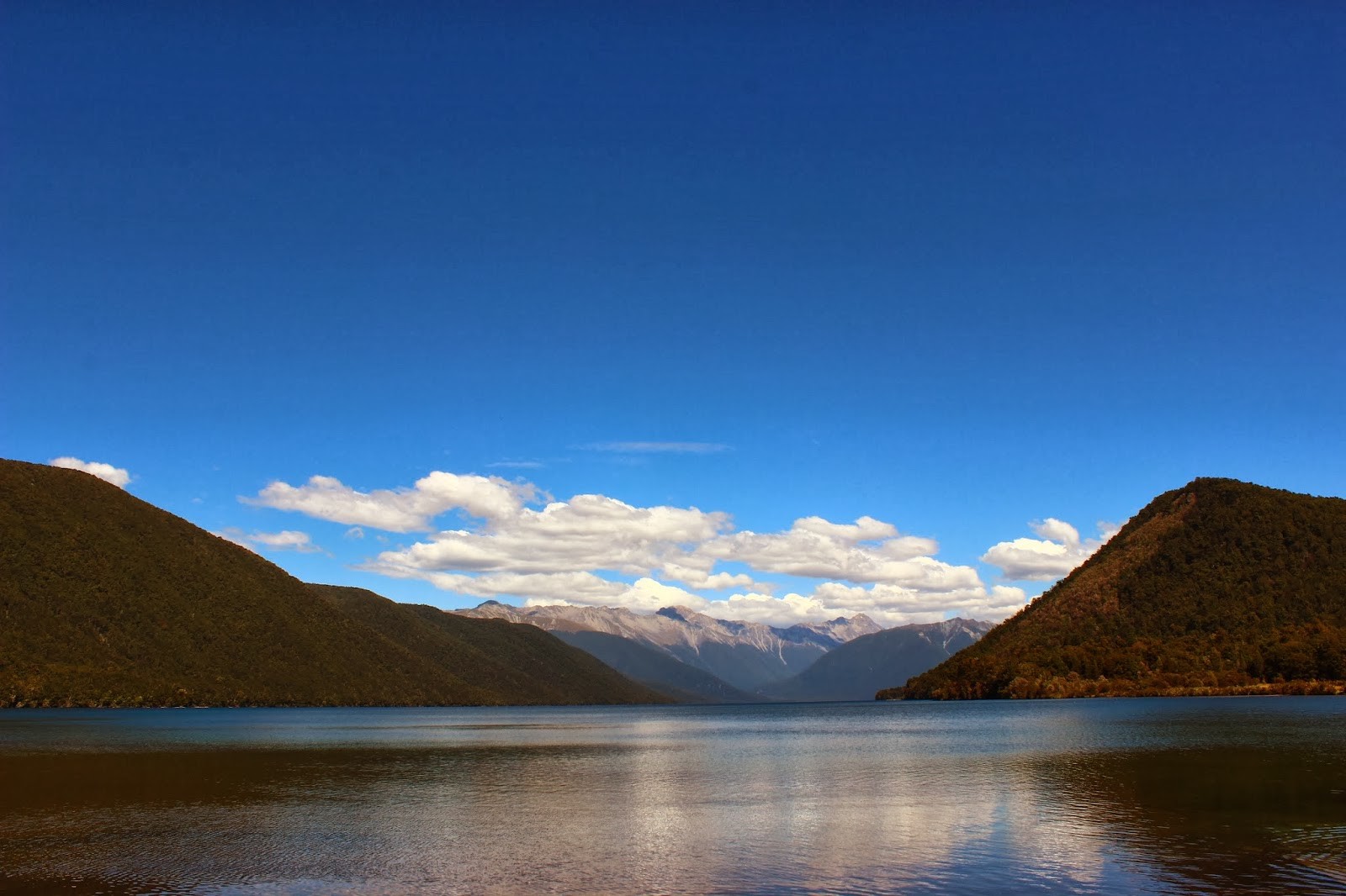
Photo gallery
Want to have your own Erasmus blog?
If you are experiencing living abroad, you're an avid traveller or want to promote the city where you live... create your own blog and share your adventures!
I want to create my Erasmus blog! →


Comments (0 comments)